
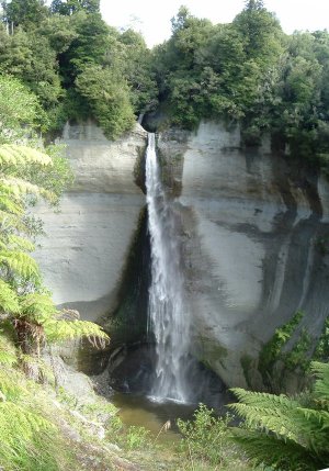

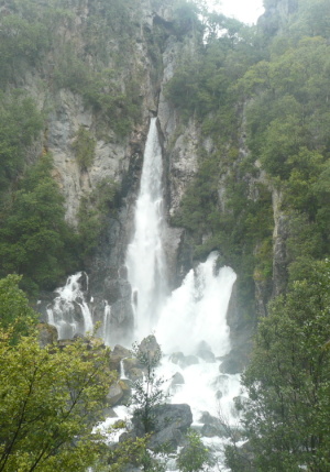
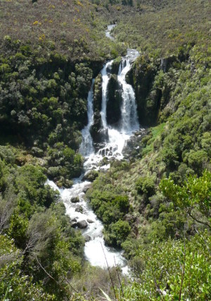
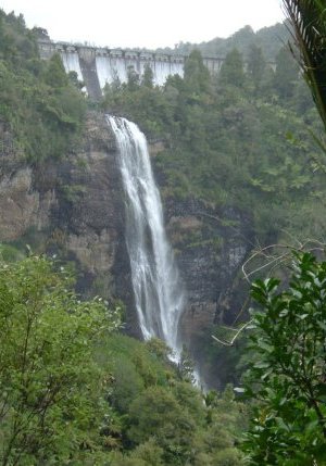
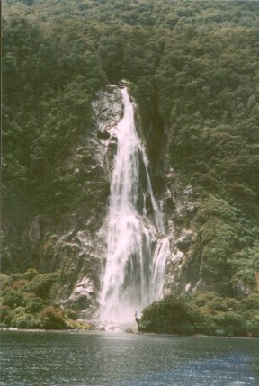
These pages depict a random selection of New Zealand waterfalls. There are a huge
number of waterfalls in the country, most of them small and known only locally, the more you go
looking, the more pop up. This site just lists a few that I've noticed. Some of them I didn't
even know existed, I'd be driving down a back road and see a sign that said 'Waterfall' -
Waitanguru, Mount Damper and Te Reinga falls come into that category.
Any heights given here I've found by searching the net, though I have to say that some of the
figures cover a fairly wide range of opinion. I've quoted the figures that seem most likely to
bear some resemblance to reality. To do any better, I may have to resort to visiting some of
these falls with a very long tape measure with a weight on the end.
I've split them into pages, about five for North Island and one for South Island. To North Islanders, the South Island (whose locals call it 'the Mainland') is almost like a foreign country, we have to actually get out of our cars and get on a boat (or a plane) to get there. However, when it comes to waterfalls, South Island has them like a dog has fleas. The far greater number of North Island waterfalls in these pages just reflects the fact that I can get to them easier. My apologies to South Islanders for living in the wrong place.
Equally contentious may be the way I've grouped waterfalls in the North Island. I've done this purely for my own convenience with no regard for regional boundaries.
This is part of the reason why the Waitakere Ranges get a whole page to themselves when only one waterfall really deserves mention. They're on my doorstep and tracking them down takes a pleasant few hours on a sunny weekend.
|
|
|
|
|
|
|
|
|
|
|
|
|
|
|
||
The heights of waterfalls seem to be one of those topics where numbers get thrown around with
great abandon, and it's hard to know whether they've been accurately measured or are just someone's
optimistic guess. Searching on the Net doesn't always help much as figures are quoted without
attribution. There's also the question of whether smaller falls above or below the main fall
are included in the quoted height, or should be.
Generally, I'd accept figures quoted on the 1:50,000 maps of the NZMS 260 series published by
Land Information NZ (formerly Lands & Survey). However not all falls have their heights shown.
Sometimes, as in the case of Thunder Creek Falls or Tawhai Falls, the quoted heights vary by a
factor of three to one, which makes one wonder if someone hasn't made a metres-for-feet error
somewhere.
In these pages I've sometimes fallen into the error of quoting heights without giving their sources;
I'll try and tidy this up. Where I say 'survey map' or '1:50,000' map I mean the NZMS series
mentioned above; generally I would regard this as the most credible source.
I would regard DOC (Department of Conservation) and regional council (parks) figures as reasonably
credible, though not always infallible. Local tourism sites I would suspect of optimism on
occasion.
In a couple of cases, where there is no published height for a fall, I've calculated the height
myself from my photos. This method only works where the fall is reasonably vertical, seen roughly
square-on by the camera (i.e. at the same level), and where the camera's distance is known.
For an example, I'll explain how I calculated the height of 'Hidden Fall' at Arthurs Pass (last item
on the 'South Island waterfalls' page).
The EXIF data buried in the JPG image gives a focal length of 36.6mm (which happens to be full zoom
for my Panasonic LZ2). At full screen, on my monitor, the fall measures 190mm on the screen.
I took, for comparison, a shot of a steel rule at exactly 2m distance and with the lens at a focal
length of 36.6mm. Bringing this photo up on screen, full-screen, 190mm (screen length) equates to
223mm actual length on the steel rule.
Using the large-scale map at NZtopoOnline, the distance from the railway track to the base of the slope
is 160m. Then, by proportion, the fall must be 0.223 x (160/2) = 18m high.
The opportunities for error in the measurements are obvious. However, in the absence of a proper
survey, the result (treated with due caution) is probably at least as accurate as most measurements.
Another good source for estimating the horizontal distance information is available at Google Maps,
the aerial photos (select 'Satellite') come with a scale on them.
![]()
Made with Bluefish HTML editor.
| Powered by | Best viewed with | |||
 |  |
 | ||