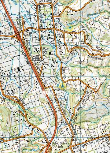
This page reaches from Northland past Auckland to, quite arbitrarily, the far side of the Hauraki Plains.
(For those Waikato-ites who will indignantly claim Wairere Falls as their own I'd point out that Auckland
Province (not the new bloated Auckland City) once stretched from North Cape to Gisborne, and for
all I know may still do. I've stopped a bit short of that).
All maps on this page are sourced from LINZ. Crown Copyright Reserved.
(Though I've added markings to some of them. Obviously LINZ have no responsibility for that).
| |
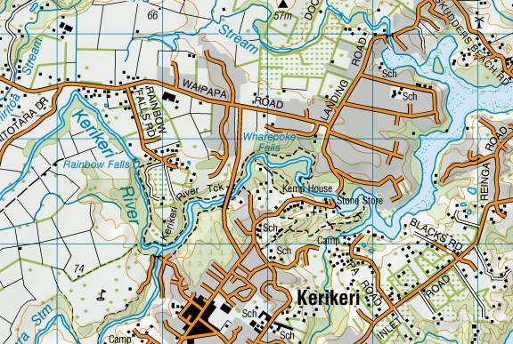
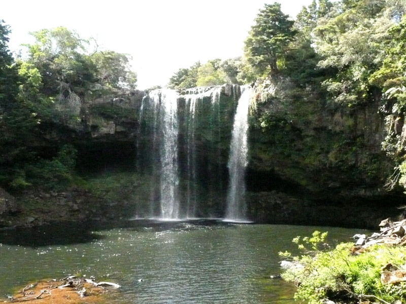
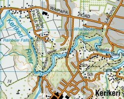
Rainbow Falls
Starting in the north, in the Bay of Islands popular tourist area, the road from Kerikeri
to Waipapa runs across an almost flat plateau, so the sign "Rainbow Falls Road" comes as a
surprise. What is more unexpected is the falls themselves, which are on a good-sized river
and of a quite impressive height, of 27m (89 feet).
|
 |
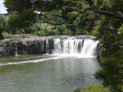
Seen from the walkway on the north bank |
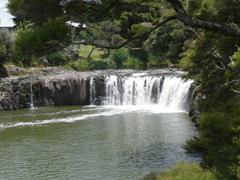
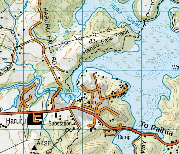
Haruru Falls
Just inland from Paihia is Haruru Falls, not very high, but with a good flow in the Waitangi River.
It's dropping into the tidal water of the inlet. The height is said to be 5m (16 feet), though presumably
this varies with the tide.

|
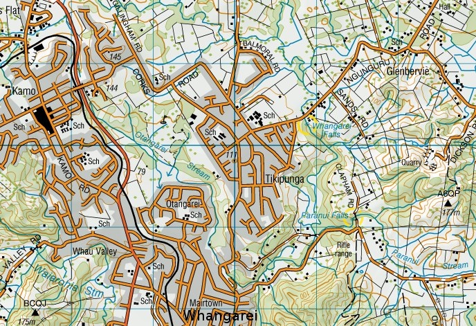
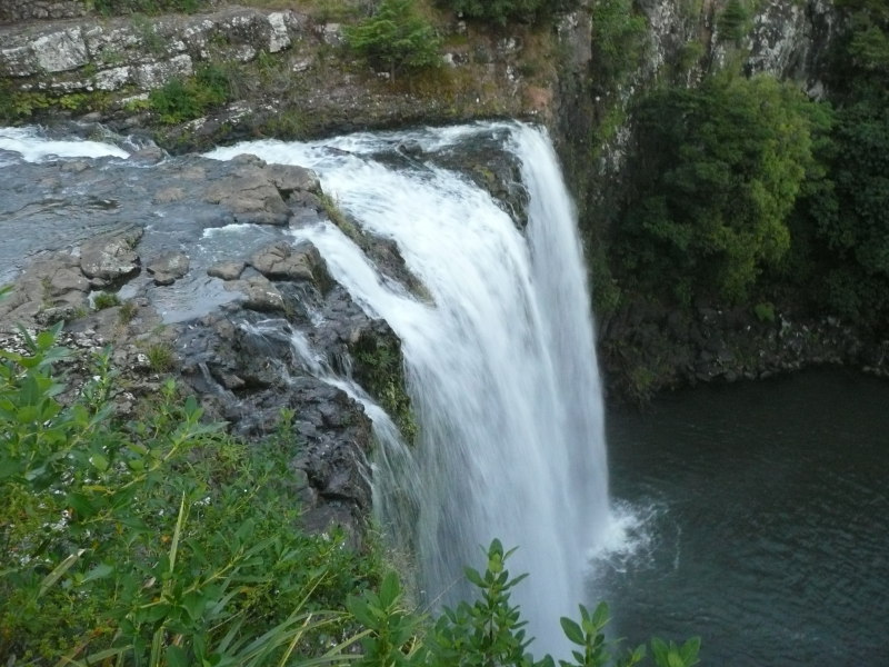
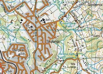
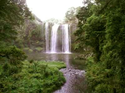
Whangarei Falls
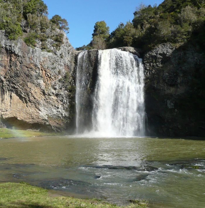
Just on the edge of Whangarei, Northland's biggest town, is this sizeable waterfall, 26m (85') high.
It could almost be the twin of Rainbow Falls. There's a park surrounding the top of the falls.
|
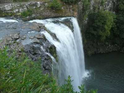
Taken from the viewing platform overlooking the crest
|
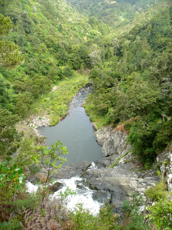
A walkway runs from the parking area, across the stream above the falls, then down into the
valley across a footbridge and back up to the top again.
The picture on right was taken at 8-38pm, ten minutes after sunset, when there
was just sufficient light for the camera (Panasonic TZ-3). The image has had the colour adjusted to
compensate for the strong blue tint that resulted. Fifteen minutes later it was night.
|
Taken from the footbridge over the river |
 |
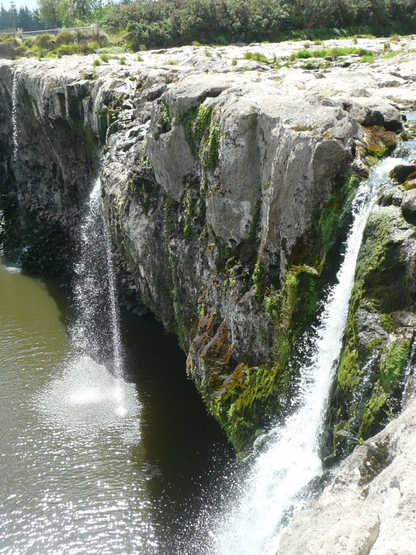
Paranui Falls
(Pukenui Falls)
A mile south of Whangarei Falls, on a smaller stream on the outskirts of Whangarei, is Paranui Falls. Nicely located in
a woodland park, probably its biggest asset is to add a destination to the walk through the kauri bush.
Although the map says 'Paranui' and it is on the Paranui Stream, the signs all say 'Pukenui'. Pukenui means
'big hill' and since the only big hill is a mile away, I think it's more likely Paranui is correct.
The signs also say it's 23.8m (78 feet) high, which raises the question what point on the slope did they measure
it to with such precision? |
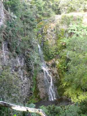
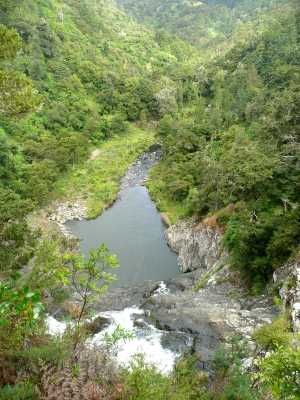
Taheke Falls
10km east of Whangarei Falls, at Whareora, is Taheke Falls, 46m high according to the map.
It is undoubtedly a most impressive cascade when seen from the right viewpoint, which would be in the valley
below or the hillside opposite. The official viewing platform (from which this was taken) is right above the
lip of the falls, looking straight down them (wide-angle lens in use). This is really about the worst angle for
photography one can get.
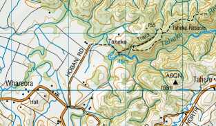
The approach is an easy track through the bush, from a marked parking area near the end of Hobans Road,
total distance about 500 yards.
|
 |
Looking across from the end of the road
|
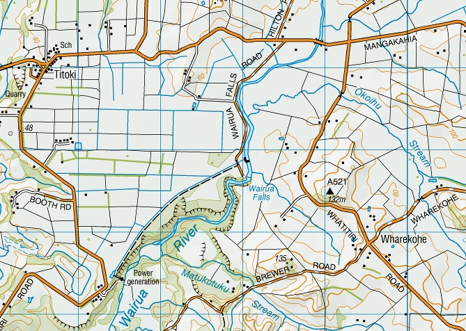
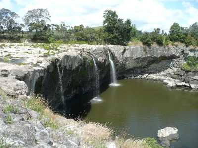
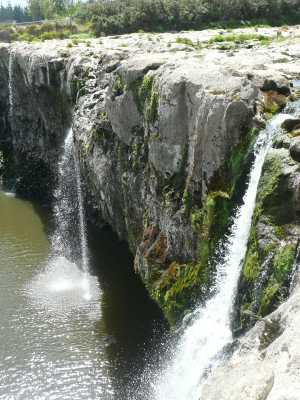
Wairua Falls
And 20km west of Whangarei, on the Wairua River which drains a huge area of swamp, are the Wairua Falls.
These are a huge waterfall when in flood (I've seen photos), but most of the time I believe them to be
dry, due to a hydro power station stealing all the water. That was certainly the case when I visited them.
Just three little streams escaped the greedy barrage upstream. |
|
 They're quite impressively wide, which is probably why their height isn't really apparent until you walk to the
edge and look down. It's a long way down! Various sources give their height from 7m to 24m. I think the
most credible figure is 15m (50 feet), and that is commensurate with the figure standing above the falls
in the old photo below (assuming he's 5'6" tall).
They're quite impressively wide, which is probably why their height isn't really apparent until you walk to the
edge and look down. It's a long way down! Various sources give their height from 7m to 24m. I think the
most credible figure is 15m (50 feet), and that is commensurate with the figure standing above the falls
in the old photo below (assuming he's 5'6" tall).
|
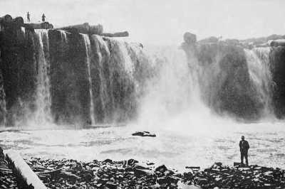 |
This old photo, taken in the kauri logging era, shows the falls in flood. The big kauri logs have
obviously grounded on the edge of the drop.
(Source: Wikimedia https://commons.wikimedia.org/wiki/File:Wairua_falls.jpg ) |
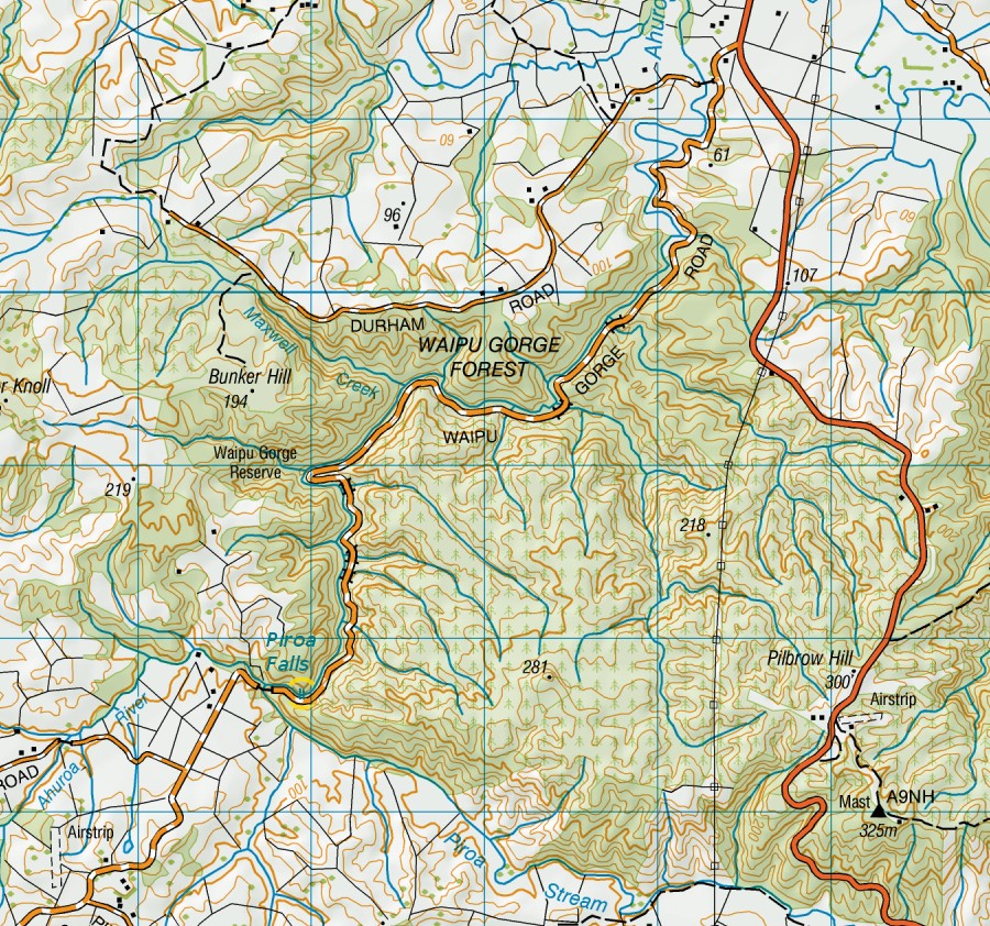
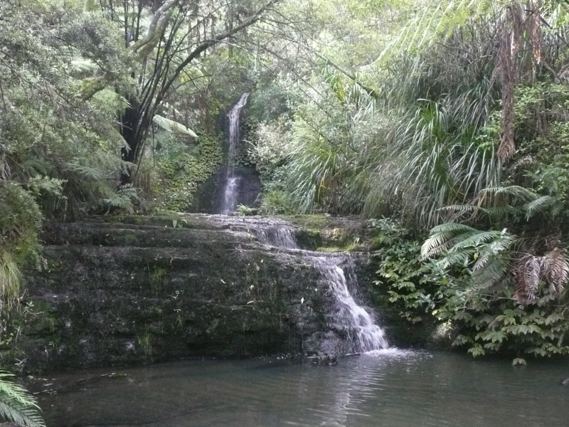
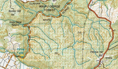
Piroa Falls
South of Whangarei, the main road runs across the long flats known as the Waipu Straights, before they hit the
steep but narrow Brynderwyn Hills. Just as the road starts to climb, the Waipu Gorge branches off on the right,
made by the Ahuroa River (boosted by the flow from the Piroa Stream which is actually bigger) cutting through
the range from the south. It's a winding four-mile gravel road to reach the falls. There's a nice easy track
that runs a few yards down from the road and up the quite picturesque gorge to reach the falls.
|
 |

|
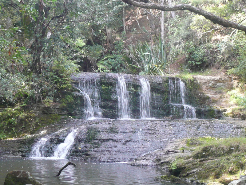
Omeru Falls
Waitangi Falls
Just by Route 16, the back road from Wellsford down to west Auckland, there are two waterfalls shown on the map. They're small,
but they do merit their own little 'scenic reserve', even if not the big ugly brown road sign erected by the tourist industry.
As it is, I spotted them first on the map, then vaguely remembered having whizzed past the road sign and completely ignoring it for the
past 20 years or so.
Omeru Falls is on a small stream, but nicely proportioned, so it looks bigger than it really is and suffers from the drought less
than the wider shallower yet-another-Waitangi Falls.
|
|

This (left) may not be fair to Waitangi Falls, though I've visited there twice and it never seemed to have much more water than this.
However, the 'real' Waitangi Falls is 100 yards upstream. Looks around 11m (35 feet) on the contours.
It was raining on me when I took this shot.
|
| |
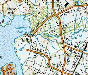
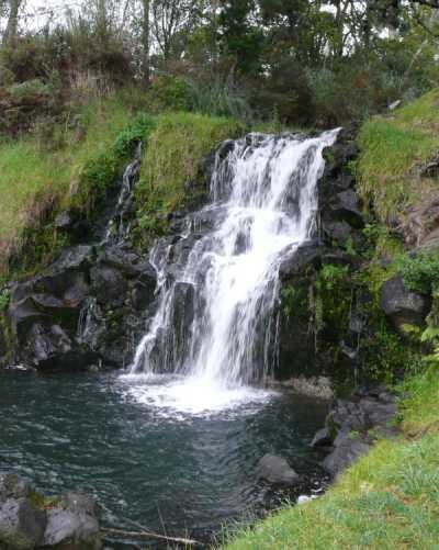
Waitangi Falls (Waiuku)
Near Waiuku, southwest of Auckland, is this surprising little waterfall. Surprising, because this is
low barely rolling country right by the edge of the Manukau Harbour. Though I've passed Waitangi Falls
Road (which turns off the main Waiuku road towards the shoreline) many times, I never bothered to
look because there just didn't seem to be enough height in the land for a waterfall.
Well, this little fall uses all the height there is. The bottom of the fall is only just above
sea level, 50 yards further down the stream drops over a four-foot cascade to high tide level,
which probably looks quite picturesque from a boat at high water when the mudflats are submerged.
This fall is well proportioned, though, which emphasises its height.
I estimated it at about 15 feet (5m) high. The airphoto says 6m (20 feet).
Note: Do not confuse this with the many other 'Waitangi Falls'. 'Wai' means 'water' and
'tangi' means (so far as my Maori reaches) 'crying out'; hence an obvious name for a waterfall.
|
|
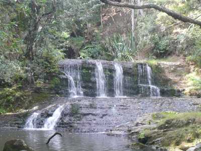
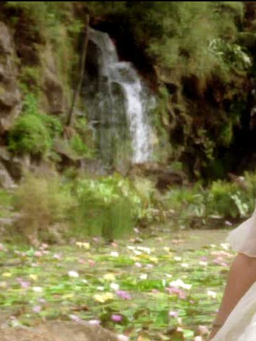
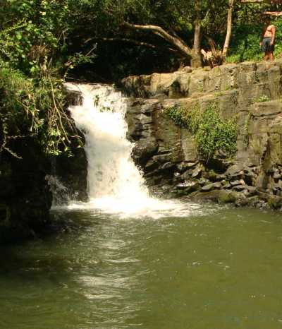
Mauku Waterfall
Some five miles east of here, in the same deceptively flat-seeming country, is a waterfall on the Mauku Stream. It's located
in Wrights Watergardens, near Patumahoe, in the site of an old quarry (I don't know if the quarry 'made' the waterfall, so to speak).
It's said to be 10m high.
(This is a bit blurred because it's off videotape, it comes from an episode of the TV show Hercules (the setting is the Elysian Fields);
while some shows such as X-F***s and St** T**k were notoriously and pathologically jealous of their property, Renaissance Pictures
were always incredibly broad-minded about Herc- and Xena-fans borrowing their characters and images. Thanks, Renpics).
|
|
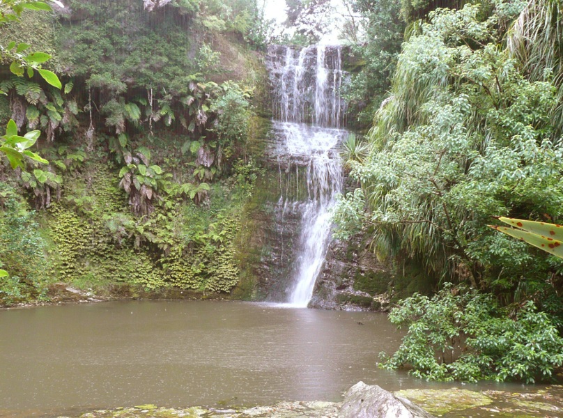
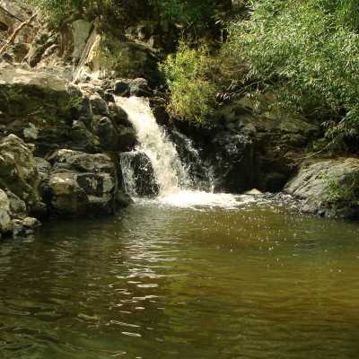
Maketu Stream
Just south of Drury where the Auckland urban area (currently) ends, the Maketu Stream emerges from the Hunua Ranges to run
across the flats. Near the base of the slope, the stream flows over this very nice fall (thanks to Brent for the photo)
... and there's another small fall just upstream.
|
|
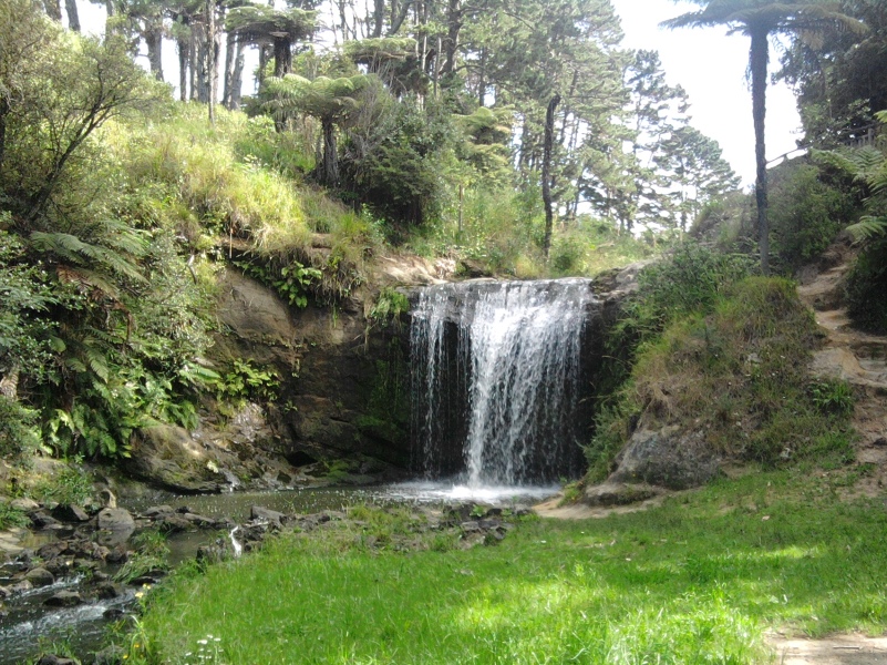
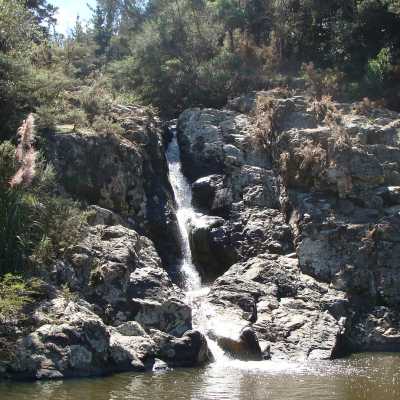
Hingaia Stream
Just over a mile to the south, on the adjoining Hingaia Stream, is this fall which is a popular swimming spot (again thanks to Brent for the photo,
and the information)
|
|
| This fall too has a small companion, in this case just downstream |
|

|
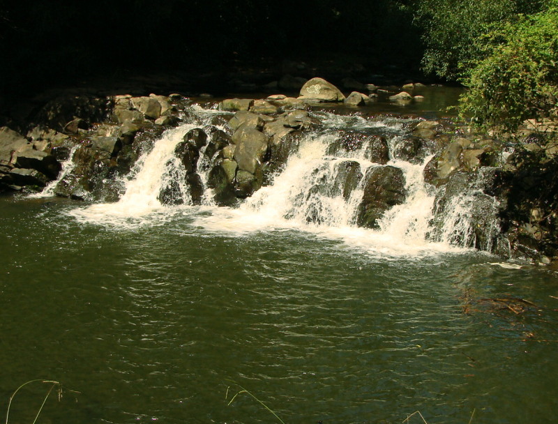
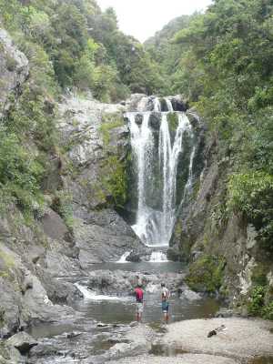
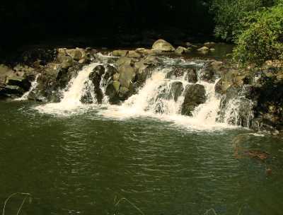
Hunua Falls
The Hunua Ranges lie southeast of Auckland. They're larger in area and a little higher than the
Waitakeres, but due to some quirk of geology they only seem to have one significant waterfall.
Like Waitakere Falls, the Wairoa River / Hunua Falls suffers from a water supply dam upstream, though in this case the
dam is much further up and at least the fall is always flowing.
|

|
Quoted as 30m (100 feet) high on the Auckland Regional Council (Parks) website. However the airphoto
(see Waitakere page for explanation) shows 26m or 85 feet.
Still plenty to jump off (as a stuntie did in a 'Hercules' tele-movie and as the helpful sign warns you not to).
And this a couple of days after heavy rain, when the falls were flowing more vigorously. From the
way the reeds on the stream banks were flattened, the river must have been up six feet higher
than this at the peak of the flood. |

|
And this is taken from the track that leads to the top of the falls. Well, actually it leads as far as a small wooden
barrier with a 'No Access' sign on it. Should you venture further you eventually come on a sign that says "No Jumping.
Death or serious injury may occur. Submerged objects in pool. 14 deaths have occurred." I can't say that the idea of
jumping off a 100-foot cliff had struck me as a Really Good Idea, but I suspect most of the aspiring high divers probably
landed short. The stuntie in 'Hercules' jumped off a specially-built platform in the middle of the falls and I bet they
searched the pool thoroughly for obstructions beforehand.
|
 |
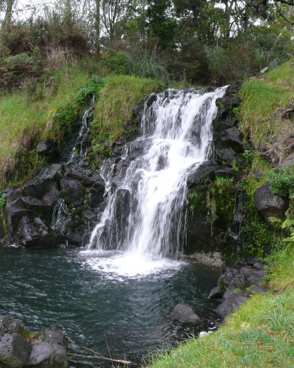
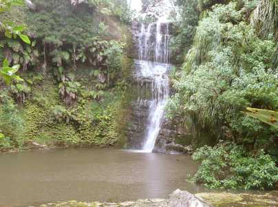
'Mathis Falls'
About two miles down the Wairoa River below Hunua Falls, on a side stream, is this nice little waterfall.
The stream is Hunua Stream, but we're calling it Mathis Falls after the nearest road since 'Hunua Falls' is taken.
Brent Daglish discovered it while kayaking down the Wairoa. He comments that the only land access (other than crossing private
property) is up the old disused and washed-out Wairoa River track from McNicol Road - quite an expedition. He reckons the fall to be
6-7 metres high.
|
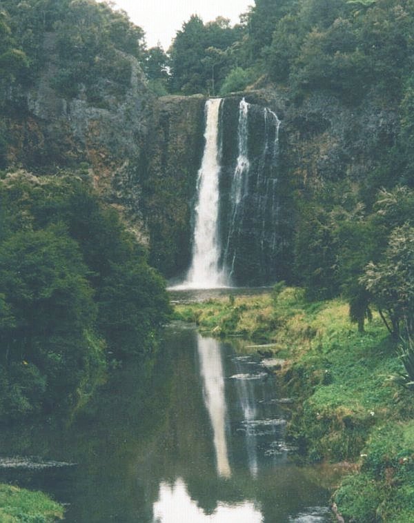
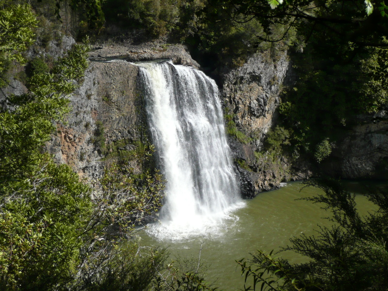
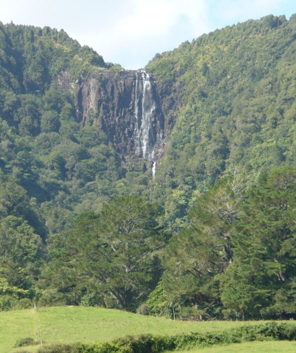
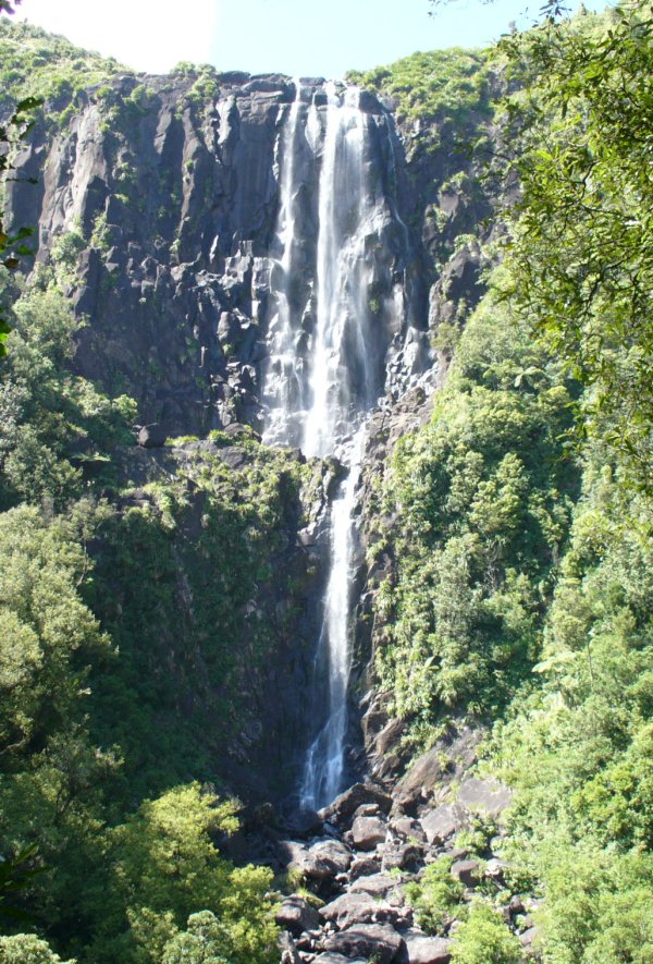
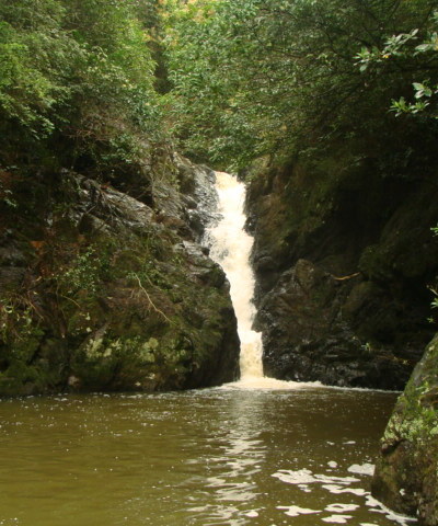
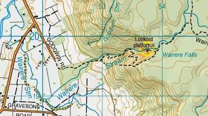
Wairere Falls
The Kaimai Ranges are an impressive line of mountains that run in a straight line along the eastern
edge of the flat swampy Hauraki Plains. The side facing the plains is steep, but on top, they're
almost a plateau, which is how waterfalls of good size and height can find enough catchment area to exist.
You take the long, straight (but rarely busy) road southeast from Te Aroha, alomg the edge of the plains,
for about 15 miles (or, head east from Matamata and turn left at Okauia).
Wairere Falls can be seen in the distance from Goodwin Road, and looks good in telephoto, but in real
life the falls are most impressive close up, where their size is apparent.
|
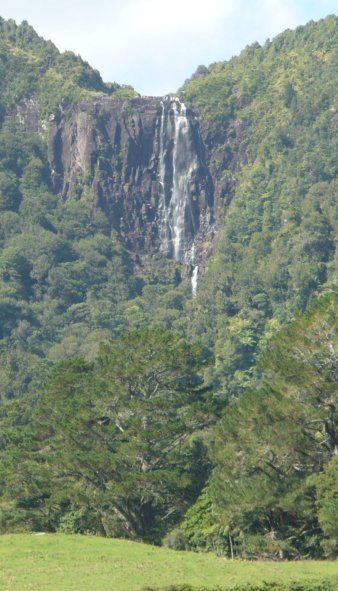
The upper falls, seen from the road
|
|
There's an
interesting and pleasant walking track that runs up the steep gorge of the Wairere Stream, then
climbs to a timber viewing platform - thick bush hides the view from anywhere else.
| 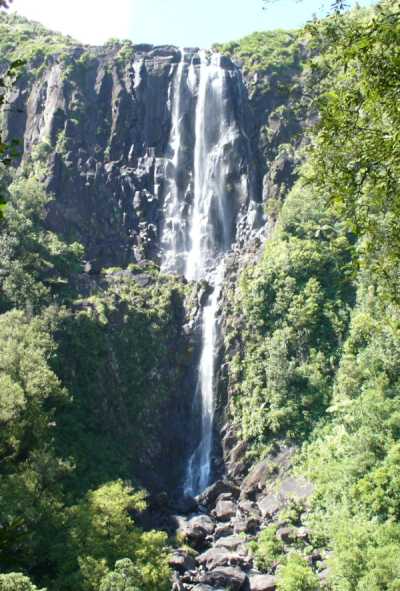
Seen from the viewing platform
|
The track climbs steeply beyond the platform to reach the top
of the plateau, then descends gently into the shallow valley of the stream above the falls. The
view from up here is equally impressive, in a different way - the stream is wide, shallow and
tame, flowing gently across the flat plateau - then it just disappears abruptly over the edge.
Beyond is a lot of airspace and, a thousand feet lower and miles away, open fields.
These are the highest falls in North Island, at 502 feet (153 metres). (Height quoted on the DOC -
Department of Conservation - website, so I should hope it's correct).
| 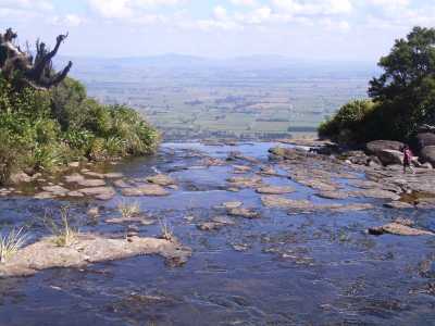
The edge of the world |
Ananui Falls | |
|
Ananui Falls, 345 feet and second highest in North Island, is also in the Kaimais, 15 miles to
the north but on the other side of the ranges. No photo because I haven't been there yet.
| |