Central North Island waterfalls
These are waterfalls on the 'central plateau' of North Island, on the rivers flowing off the volcanic mountains of the Tongariro National Park. Plus a couple in the general vicinity.Huka Falls
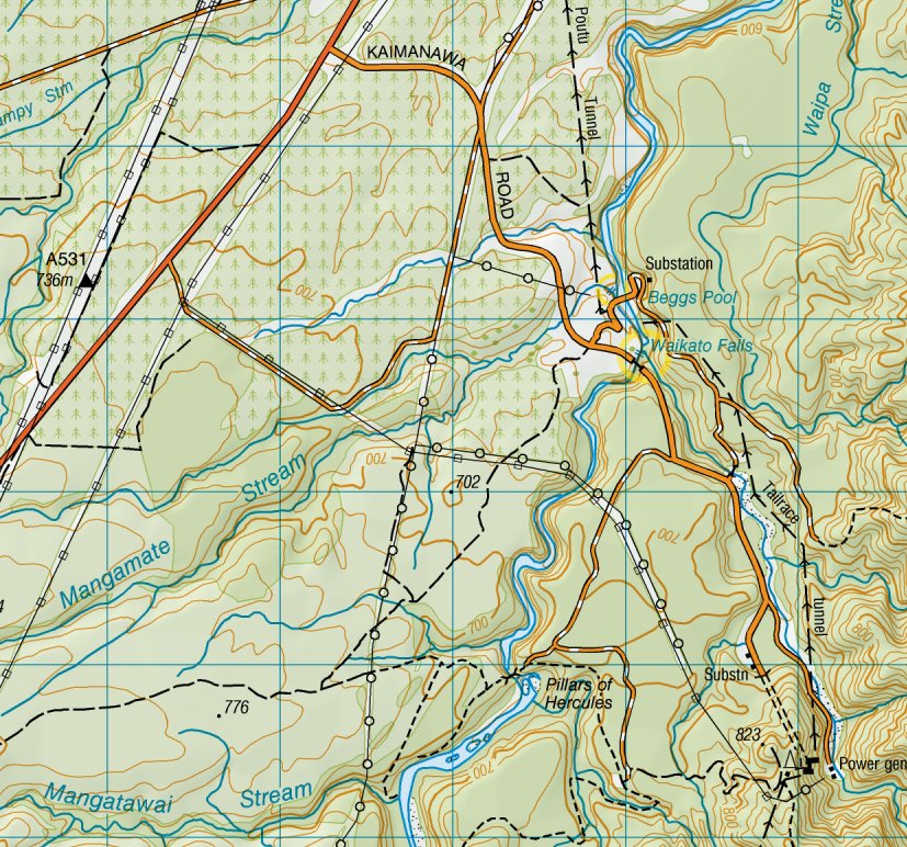
This is probably the best-known waterfall in North Island, on the Waikato below Lake Taupo. The Waikato is North Island's largest river, but has no high waterfalls. This is really just the last and biggest of a line of rapids in a straight, narrow trench-like gorge. Its small drop is made up for by the volume of water flowing over it. It's a violent waterfall and looks it. A few 'extreme' kayakers have gone over it deliberately and survived.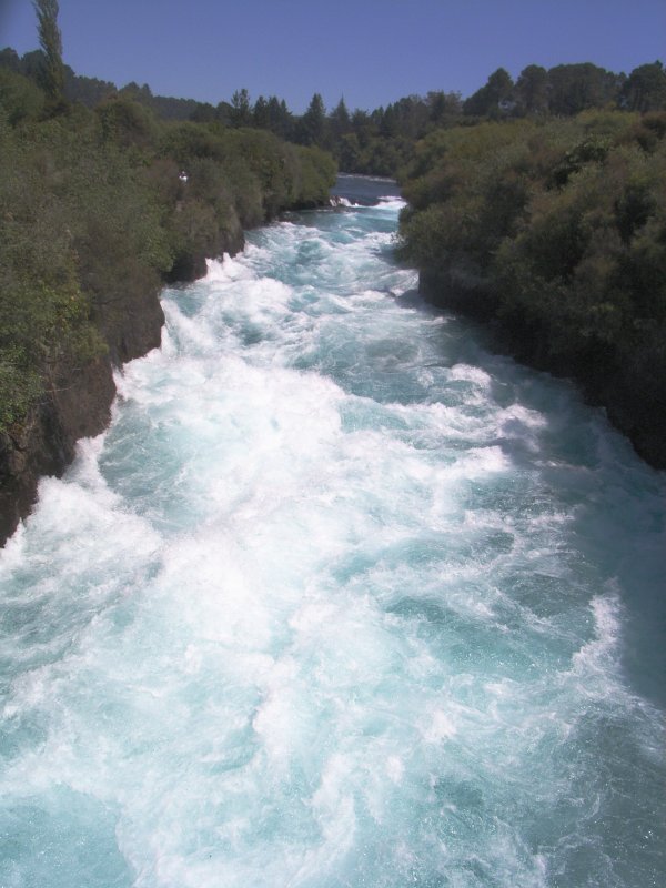
Looking upstream from the footbridge across the rapids
Aratiatia Rapids, a few miles downstream, may well be just as dramatic when flowing, but most of the time they don't flow, having been robbed of their water by a hydro dam.
The white water was so bright in the sun that my camera under-exposed everything else into shades of black - I had to tweak these shots drastically to get any detail of the surroundings to show up.
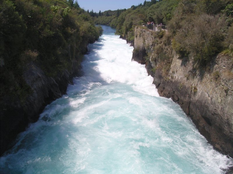
.... and downstream. Huka Falls is at the far end of the 'trench'

Looking upstream from the bridge. It looks as if there's
another fall or rapid just round the corner,
but no way to see it without rock-climbing.
Looking downstream from the bridge.
Beggs Pool and its shingle bank just visible at top of photo.
Waikato Falls
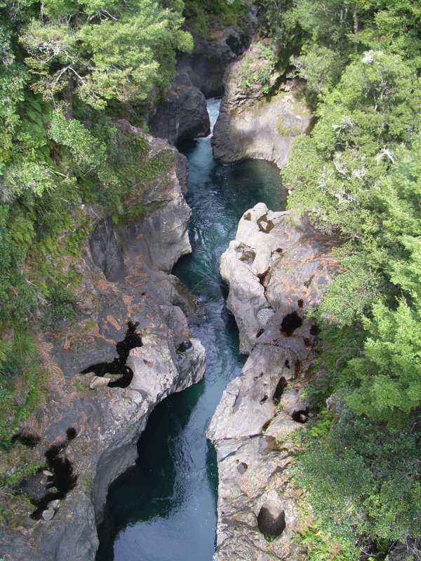
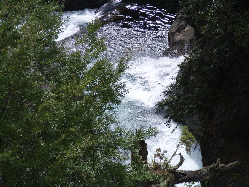
Above Lake Taupo, the river continues as the Tongariro River, famous for trout fishing; only in its headwaters does the name change back to the Waikato Stream. However, to help the confusion along, 15 miles up the Tongariro River are the Waikato Falls. The river twists through a deep, narrow gorge, the bottom so narrow and undercut in places that it's difficult to see the water from the road bridge which spans the gorge high above.This area is reached via Kaimanawa Road, which turns off State Highway 1 ten miles south of Turangi.
At the lower end of this tortuous defile, the gorge opens out and the river pours over the last barrier of rock into a large pool - Beggs Pool.
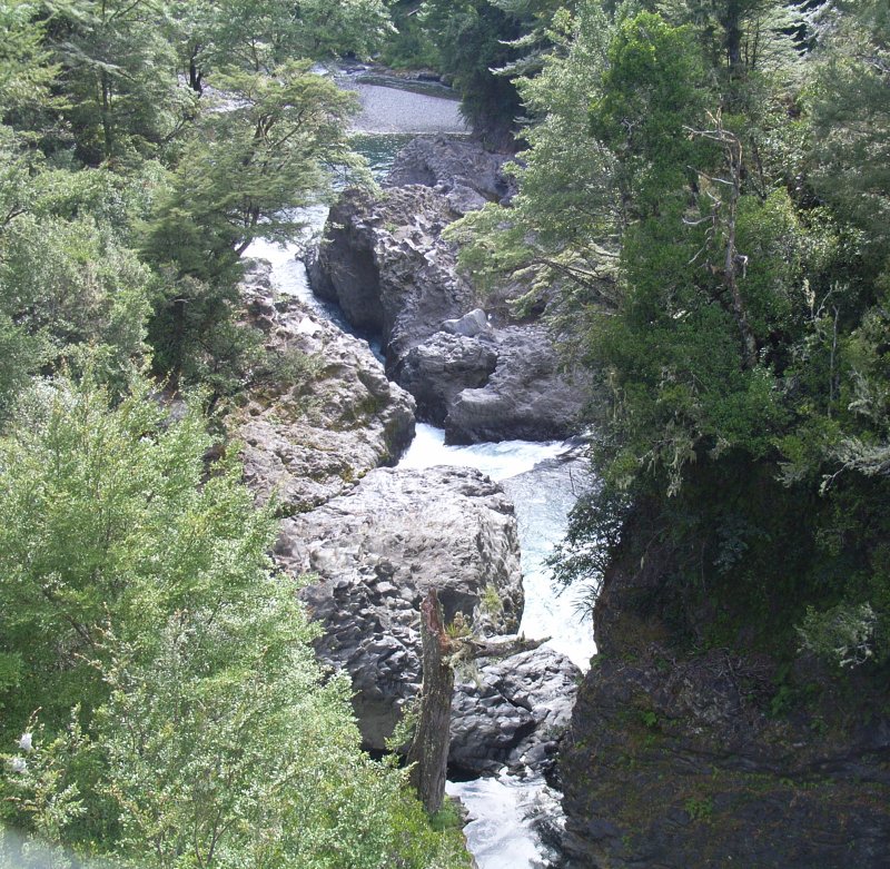
From further to the left - this looks like the bottom
of a cascade or fall coming in from the right.

Seen from the shingle bank in Beggs Pool.
This is, presumably, Waikato Falls itself - or maybe the name encompasses all the various cascades in this area.
I estimate the lower fall at 3.4 metres (11 feet) high.
Mangamate Stream, Tongariro River in foreground.
Mangamate Fall
...but this piece of enthusiastic scenery hasn't finished yet - as you turn to leave, straight in front of you as you re-cross the river on the barrage, is this waterfall on the Mangamate Stream as it drops into the Tongariro gorge. Now shown on the latest map. (I'd like to think that has something to do with the email I sent LINZ, pointing out its existence; they are responsive to the public, all credit to them).A tortuous chain of calculations involving downloaded aerial photos from Google Maps (to establish the camera's distance from the falls), the focal length recorded by the camera in the EXIF data, a photo of a scale rule taken at a known distance and focal length, and measuring lengths on my monitor, suggest that this fall is 14m (46 feet) high, not including a small upper fall not visible in this photo. But I think it looks higher.
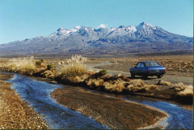
Tukino
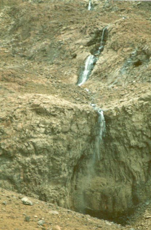
Higher up the river, above the point where its tributaries dry up in the 'desert' for much of the year, is an unlikely spot for a waterfall - a skifield. Well, this was autumn on Mt Ruapehu, with no skiers and no snow. There's still snow two thousand feet above, which is where these waterfalls are coming from. This is at 5500 feet on the east side of the mountain, the headwaters of the Mangatoetoenui Stream, just above the Tukino ski club lodges. As you can see, it was windy: a waterfall when it left the top, just heavy rain when it reached the bottom.
The stream in the foreground is the Waikato River, or at least, the nominal headwaters of same. People won't believe me when I say I've jumped and driven across the Waikato.
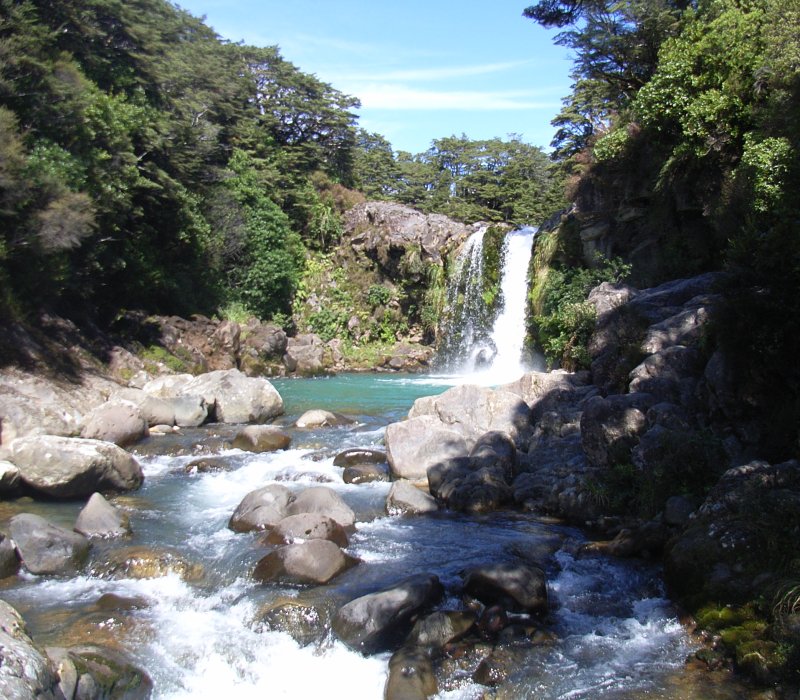
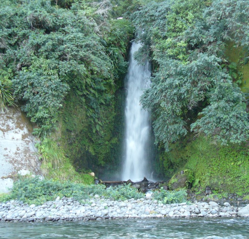
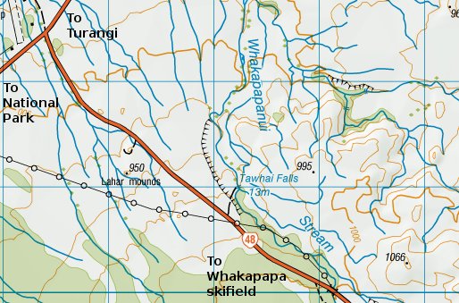
Tawhai Falls
Heading over towards the more fashionable west side of the mountain, just off the road up to Chateau Tongariro and the Whakapapa skifield, is this very pretty fall.In fact I think it actually looks higher (and better) in this shot, than when more water is going over.
According to A Guide to New Zealand Waterfalls, this is just 5m (16 feet) high, though the survey map gives it as 13m (42 feet). Just from the look of it, I'd like to believe the map. However, scaling off my photos indicates 6.5m. This one would be easy to sort out with a piece of string and a weight on the end. All I need to do is go and do it.
This is on the Whakapapanui Stream, which was still flowing quite well even at the end of a long dry summer.

Just a trickle in late summer...
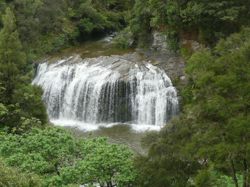
And this is in late spring, with a lot more water about.
That was a pretty safe bet, wasn't it?
Kawautahi falls
Northwest of here, 12 miles west of Raurimu, are these falls, of quite respectable size. Just from the look of the riverbed, I would expect the flow to normally be greater, but this was taken towards the end of the driest summer for 40 years. I was driving along a gravel road in the middle of nowhere, as one does, and there right below the road were these falls, in a scenic and lush setting in contrast to the otherwise rugged countryside.
They don't seem to be marked on the map (though they can just be discerned on Google Maps satellite view), but they're on the Kawautahi Stream, alongside Kawautahi Road just over a quarter of a mile north of its junction with Oio Road.

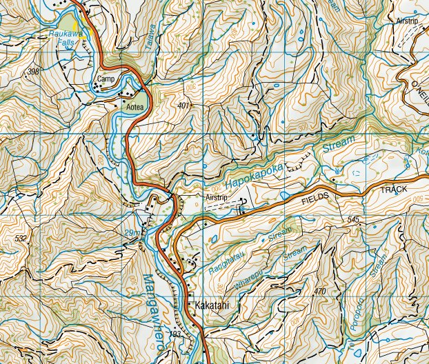
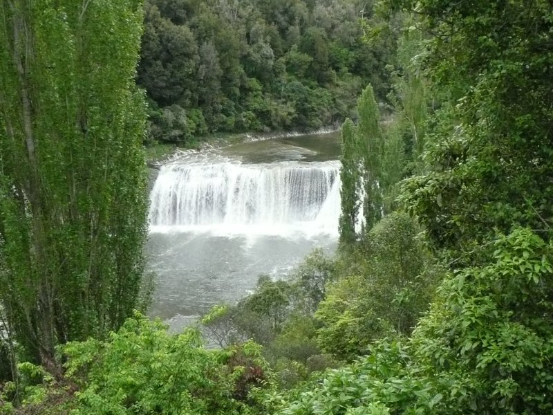
Raukawa Falls
On the road (SH4) from Wanganui up towards Raetihi and the central plateau is Raukawa Falls, on the Mangawhero River. This is a quick snap taken from the roadside pull-off area (where everyone + dog takes a quick snap). I think, given a little more time, other equally interesting viewpoints could be found.This fall is 20 miles (30km) south of Raetihi and 2 miles (3km) north of the junction of Fields Track. Watch for the brown advance warning signs for the pull-off area, other than Fields Track there's little in the way of landmarks to check your progress.
According to A Guide to NZ Waterfalls this fall is 15m high and 50m wide (that's 50ft and 165ft) - that seems about right to me.
Waterfalls seen from the train
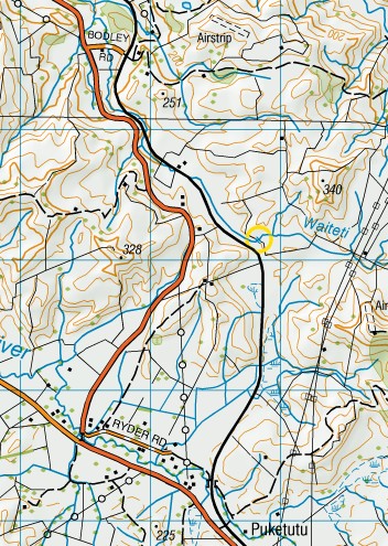
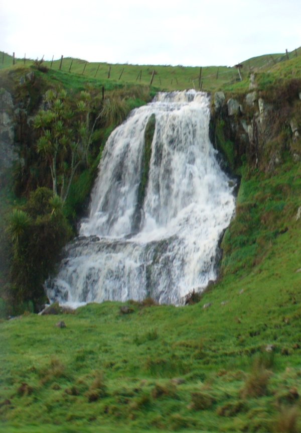
One doesn't normally go waterfall-hunting in a railway train, so I find it intriguing that I've spotted five from the Auckland - Wellington passenger train, the Overlander. And none of them would be easily spotted from the road. I've listed them from north to south.Waiteti waterfall
This one is un-missable, just a few yards from the main railway line. It's a charming little cascade on the headwaters of the Waiteti Stream, about 7 miles south of Te Kuiti and a mile south of the Bodley Road railway crossing. (I originally placed it on the little tributary just north of Bodley Road - I was wrong, as a study of Google Maps airphotos shows). I'd guess it's maybe 50 feet high (scaling off the fenceposts at the top and knocking off a bit for perspective). I saw it from the southbound 'Overlander' train, though too late to snap a photo; on the return trip I was waiting and got this quick shot.This was after heavy rain, so it has a better flow than usual.
Mangaturuturu waterfall
Up on the volcanic plateau, south of National Park, the train crosses the high Makatote viaduct while the main road winds down and across the gorge below. Beyond this, road and rail run straight, side by side across the plateau, and cross the next gorges of Mangonui-o-te-ao and Mangaturuturu in the otherwise flat plateau quicker than you can say their names. Which is probably why I'd never noticed this waterfall from the train before, and from the road it's hidden behind the span of the railway viaduct. I was planning to take a shot of Mangaturuturu gorge from the train as we crossed it and as you can see, my hasty snap was only just quick enough. The waterfall was a complete surprise.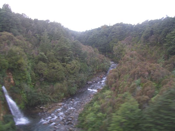
The waterfall is on an unnamed side stream which drops into the main Mangaturuturu River gorge so 'Mangaturuturu Falls' is probably not the right name.
And here it is, seen head-on across the gorge on a day in late spring. This time, I parked on the road and walked across the railway line (beware trains!) to the edge of the gorge. This was a very grey day, hence the washed-out colours.
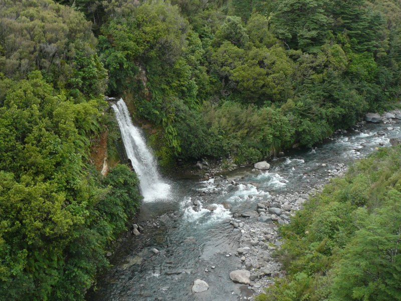
Caught me by surprise the first time...
Hautapu (Turangarere) waterfall
On the descent from the high plateau at Waiouru to the valleys at Taihape, the line follows the valley of the Hautapu River. At Turangarere, the river doubles back on itself, and the railway sweeps round in a horseshoe curve of 200 degrees to follow it, and right in the neck of the horseshoe is this fall. I believe a better view is possible from the train, if I got the timing right, and possibly better still from the track alongside the railway line, if it were public - but it isn't (it has a gate on it, which is shut).At a rough guess, and assuming that's a patch of water we can see below the fall in the second photo, it might be around 20 feet high.
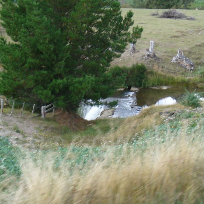
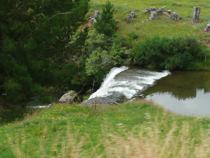
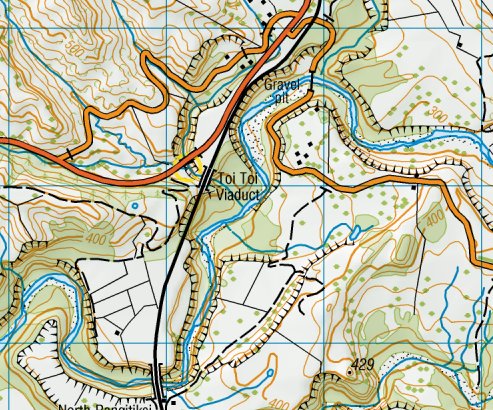
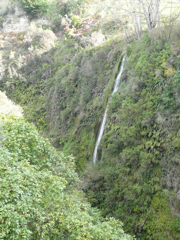
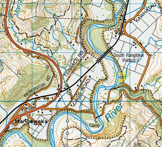
Toitoi waterfall
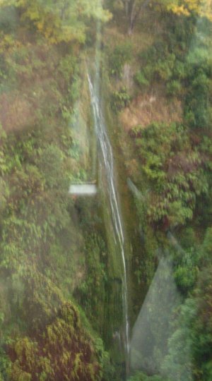
50 miles south of the volcanic plateau, beyond Utiku south of Taihape, the line reaches the Rangitikei River. This is an area of curious and dramatic scenery, where wide flat valley bottoms have been cut into by deep narrow sheer-sided gorges. As if, geologically, the landscape had reached the 'mature' stage, then for some reason the Rangitikei River and all its side streams started down-cutting furiously again.Just after the Rangitikei gorge is sighted, the line crosses the Toi Toi Viaduct, where a small tributary stream has cut a knife-edge gorge down to match the level of the main river. This is looking up the gorge, another small tributary drops into the gorge in this small waterfall which seems to be permanent (I've seen it still flowing at the end of a very dry summer). Its height is quite respectable - the viaduct is 58m (190') high, and the fall wouldn't be much short of that. The reflections in the glass reflect my unreadiness - I wasn't on the outside viewing platform in time.
And this is the same fall, seen from the end of the road bridge on State Highway 1 where it crosses the gorge some yards upstream of the railway. It's such a narrow, knife-edge gorge that it's impossible to see the full height of the fall from one place; the stream at the bottom is hidden by the curvature of the gorge walls. You'd never find it unless you knew it was there.
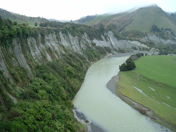
Rangitikei Gorge waterfall
Just south of here, the railway crosses and re-crosses the Rangitikei River gorge on a pair of high viaducts. It never fails to startle people - one moment you're racing across flat fields in the wide shallow valley bottom, with no sign of a river to be seen, then without any warning at all you're in mid-air 250 feet up.
(in yellow circle). Whether the stream has taken a short-cut
or this is just a wet-weather overflow, I don't know.
This waterfall appears to be an ephemeral one, flowing only after heavy rain. I can state its height fairly accurately - the railway viaduct is 75 metres (246 feet) high, so are the cliffs, therefore so is the waterfall. And that estimate is probably at least as accurate as many of the other heights quoted on this site!
(Apologies for the bad framing of the photo - I was zooming in a hurry.)
I suspect there may be many other small waterfalls in the Rangitikei gorges area, maybe only flowing after rain - with the sheer gorge sides, any side stream that hasn't managed to cut down to river level must end in a fall. But the only practical way to find them would be by rafting down the river.