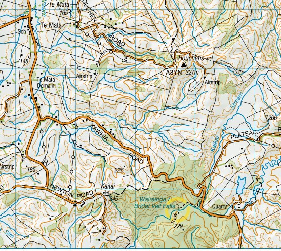
Down the west coast
From Auckland, heading south-west down towards New Plymouth, the area bordering the coast is hill country, thinly settled, with no sizeable towns. It has a 'back-of-beyond' feel to it that appeals to me.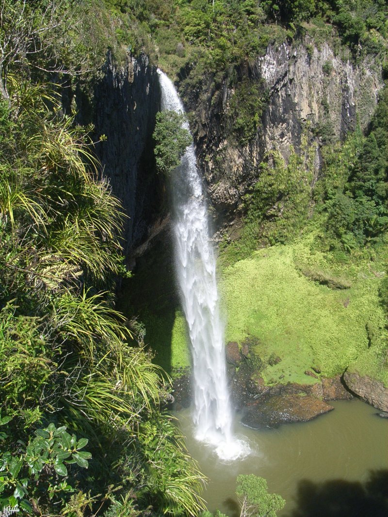

Bridal Veil Falls
20 miles west of Hamilton, 8 miles down a turn-off off the Raglan road through Te Mata village, is Bridal Veil Falls, a single drop of quite respectable height. A walking track leads gently downhill through the bush for four hundred yards to the head of the falls, then steeply down to their foot. This is really a very elegant and simple fall, the stream flows to the edge of the cliff, it goes straight over, it hits the bottom 55 metres down, that's it. No rapids or cascades to complicate things. And the water stays in a concentrated jet which makes the patterns in it the more fascinating.(180 feet, in case you were wondering. Sounds much more impressive in Imperial units, doesn't it?)
(55m is according to DOC's website).
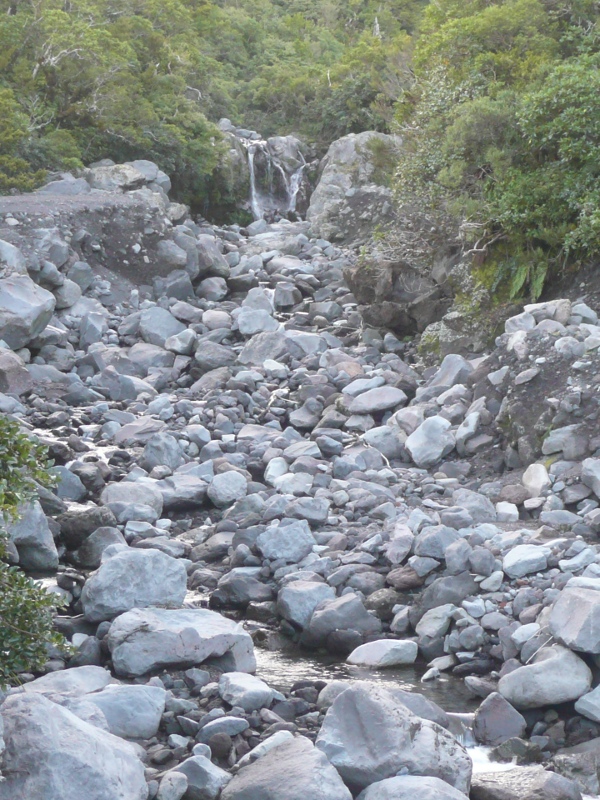
The (gravel) road south is blocked by a slip at the Te Maari Stream,
for about the last three years;
to reach Kawhia that way you have to go back and round via Te Patupatu
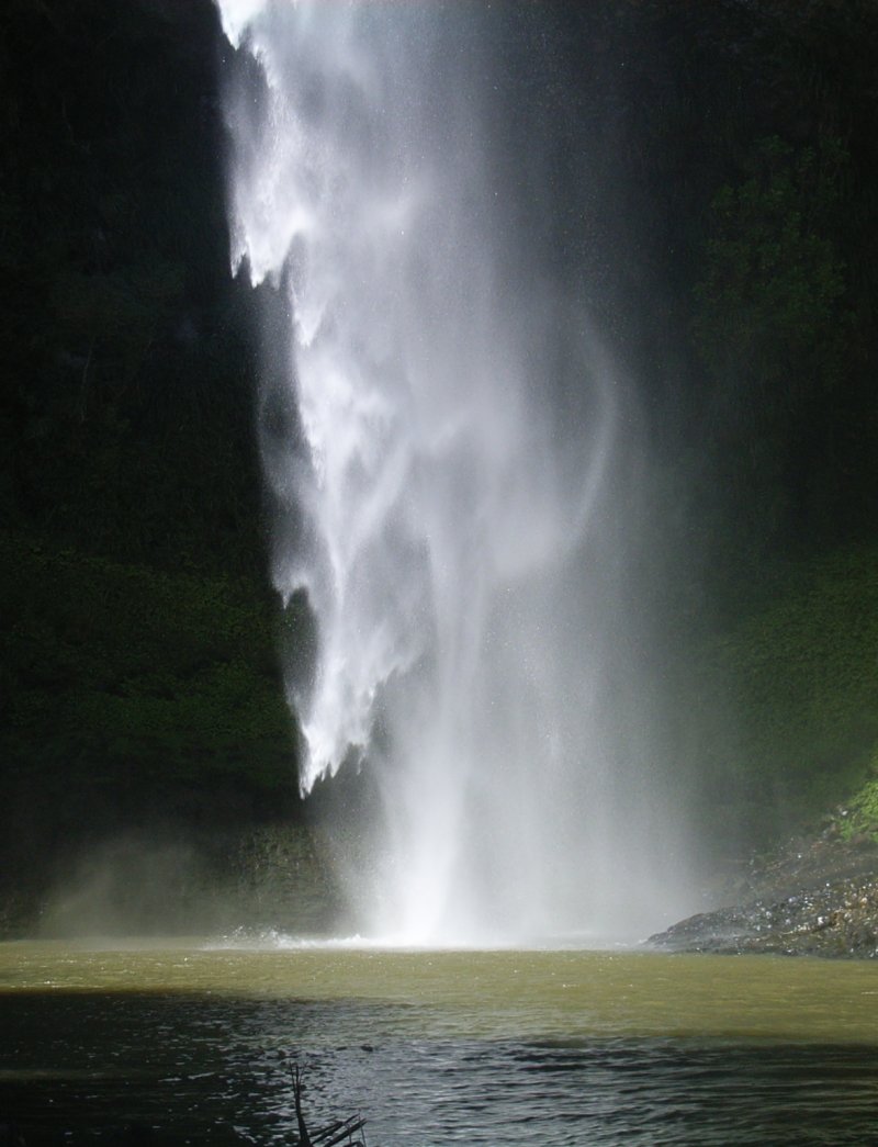
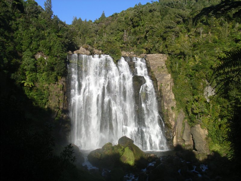
Taken from the stream at the base of the fall. A gust of wind is blowing the bottom of the fall sideways.
This fall faces west, I got there at 12-30 just after the shadows were off it (my first bit of lucky timing on my Easter trip, I couldn't have afforded to wait here very long).
Awaroa waterfall
20 miles south of Bridal Veil Fall, in the 'back of beyond' well away from the tourist trails, is Awaroa valley, and as the gravelled Hauturu Road winds round the side of the valley to reach the ridge, this quite respectable minor fall can be seen right across the valley. This is after rain, in late summer.
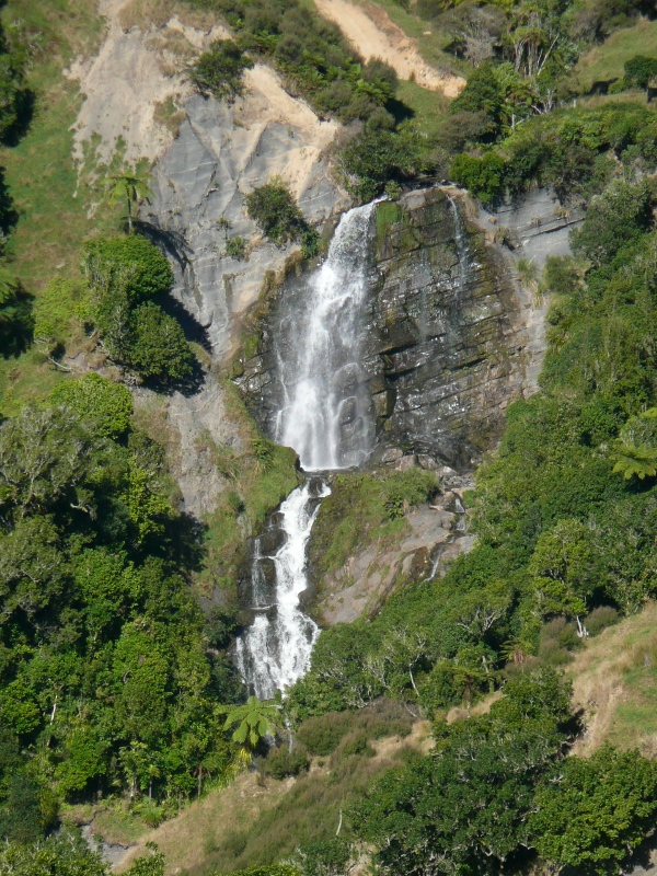
Taken in the late afternoon, hence the warm colours.
(Taken from the road just left of the 'H' in Hauturu on the map)
(Taken from the road just by the last 'U' in 'Hauturu')

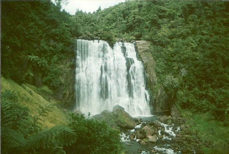
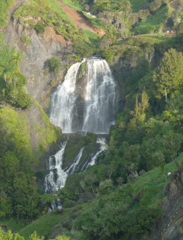
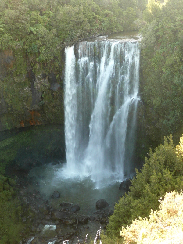
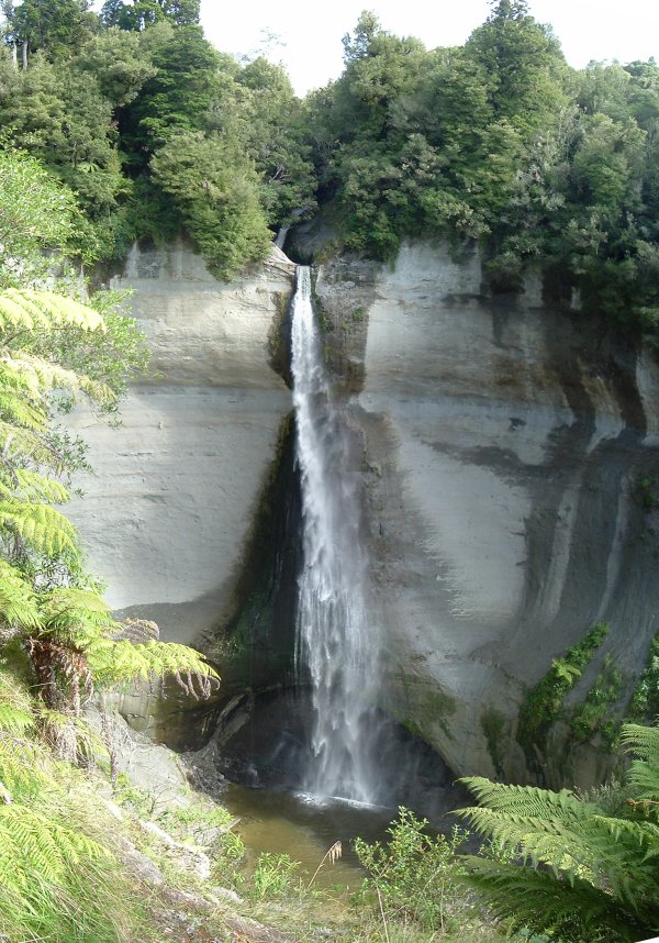
Marokopa Falls
15 miles west of Waitomo (with its well-known tourist caves) on the winding but tarsealed road to Te Anga and the coast, are Marokopa Falls, a quite substantial and handsome fall of four-square proportions. Again, it's reached by a gentle hike downhill through bush from the road. Figures I've seen quoted for the height range from 30 metres, 36m, 120 feet (same thing), to 57 metres (optimist!). DOC quotes 30m, I'll go with that.Taken on a very grey day.


Mangapohue Natural Bridge
Four miles before reaching the falls, the Mangapohue Stream, whose valley the road has been following for some time, suddenly veers off and cuts straight through a limestone ridge in a sheer-sided gorge, actually a large collapsed cave, part of the roof of which survives as Mangapohue Natural Bridge. There's a signposted parking area by the road, and a timber walkway that runs through the gorge to the cave.The stream itself has a clean sandy bed, which makes no sense to me, but then limestone country always seems a bit weird to me.
Waitanguru Falls
Ten miles due south of Marokopa Falls, in the middle of nowhere, are the Waitanguru Falls, with a surprising volume of water for a rather small catchment. I think I caught it on a good day. Again, a short track leads down from the road. Most easily reached (for those who, unlike me, don't love loose gravel roads) on the sealed road from Piopio ten miles away on State Highway 3 (the Te Kuiti - New Plymouth road).On the way, the road runs through the Mangaotaki valley, where sheer limestone cliffs jut out of the valley sides high above the road - said (according to the Internet) to be a prime rock-climbing site, though I've never noticed anyone dangling off them.


It would be quite a nice little waterfall if the
trees were thinner and the guardrail wasn't there
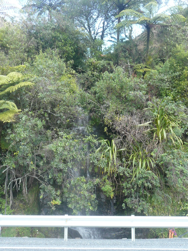
Madonna Falls
Back on the main road (S.H.4) from Te Kuiti to Taumarunui and the south is a quite impressive waterfall. This isn't it.This rates a name on the map and a road sign that says 'Scenic Waterfall'. In fact it's just a stream that tumbles down the roadside cutting, buried in the bushes, right beside the road, so one doesn't have to walk far to see it. Just be careful parking clear of the traffic.
In fact there are two such streams within a few yards of each other. Madonna Falls is probably the one that has the little vases of flowers around it, since it is reputed to have healing properties.
It may have been more attractive when it was buried in the bush, before the road got so wide and so close.
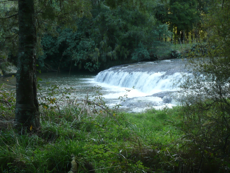
Omaru Falls
Four miles further south, Omaru Road turns off to the right (if heading south) and 500 yards along is a grass parking area with a sign for Omaru Falls. The falls are 1km (5/8 mile) down a walking track, much of it through bush, a pleasant walk and well worth it. After a half mile, and crossing a cable bridge across the fast-flowing stream, you come to this wide flat four-foot waterfall. Googling suggests that this has on occasion been mistaken for Omaru Falls. It isn't. Keep going.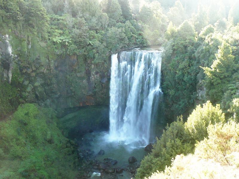

The mistiness in the air is only slightly due to lens flare in my camera, much of it is due to spray mist in the air backlit by the sun. (And these photos have been cleaned up digitally as much as I could).
There is said to be a path down to the base of the falls, though it isn't obvious and some caution would be indicated.
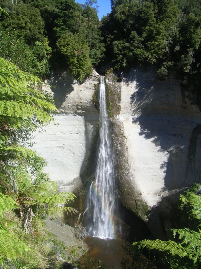
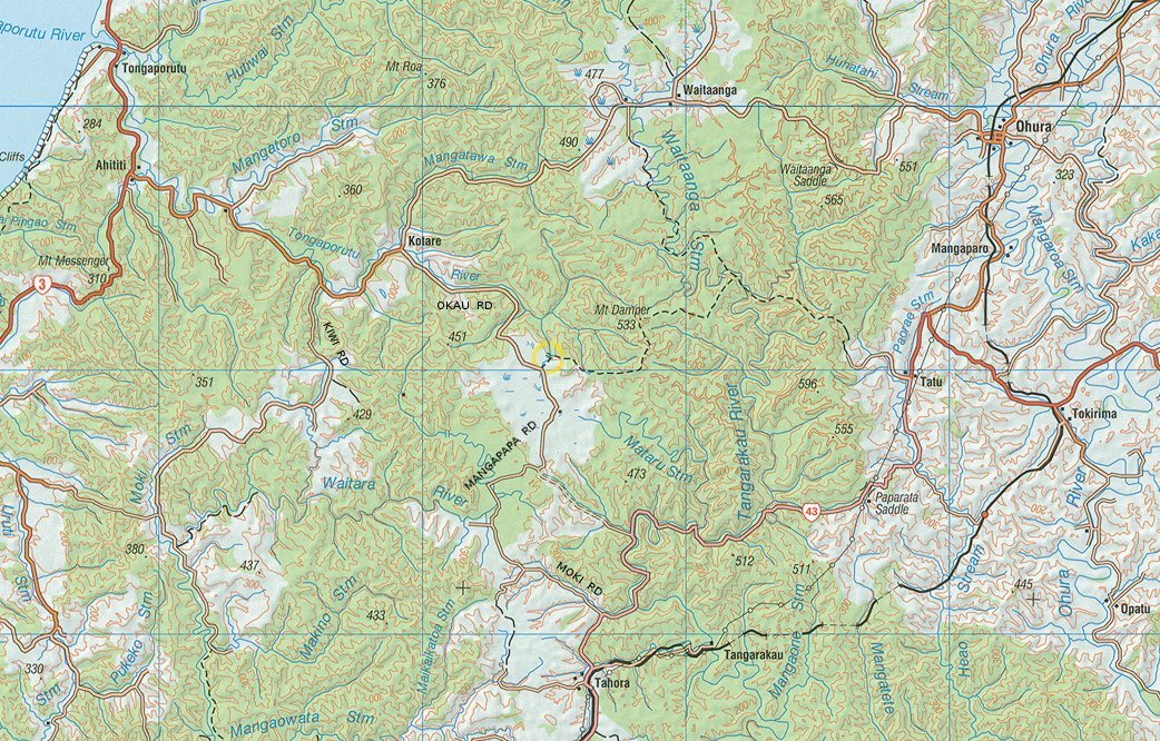
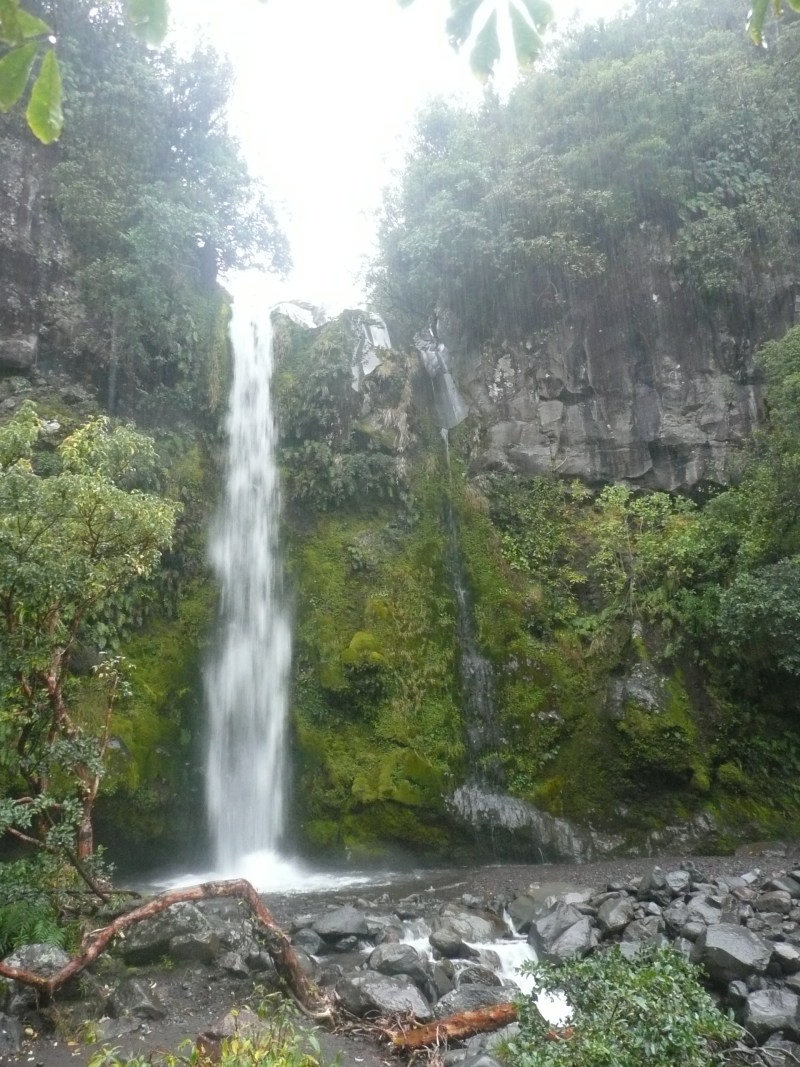
Mt Damper Falls
Heading way back to the west, into the real back country, are Mt Damper Falls. They're off Okau Road, a gravel road that branches south off the Ahititi-Waitaanga road (do not turn down Kiwi Road by mistake, unless you love excursions up narrow hill roads for their own sake); and eventually leads out to the Whangamomona - Taumarunui road (Highway 43).The walking track to the falls leads alongside a stream which drains an upland swampy area, gradually descending through the bush, and then drops dramatically into the head of a sheer-sided valley of its own making.
Heights I've seen quoted range from 74m (243') (DOC figure) to 85m (280'). It isn't stated whether this includes the short upper falls. This would make them probably the fourth highest in North Island (after Wairere, Ananui and Waitakere Falls).
(DOC used to say 'highest in North Island', but this has been amended to 'one of the highest in North Island' - I'll go along with that).
(A track branches off from here signposted 'Te Rerepahupahu Falls - experienced trampers only', it gives the time as 7 hours but omits to mention if that includes the return trip. I haven't tried it.)
This is a composite of three photos taken with a 35mm (equivalent) lens from the viewpoint on the opposite side of the valley. The photos were combined using Hugin/Enblend, and a beautiful job it did too.
The 'bend' in the fall of the water is real, not an optical illusion or a 'feature' of the software - there was a strong wind gusting around the semi-circular valley head and blowing the water sideways.
(Easter 2006)
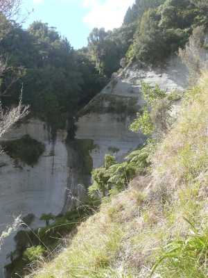
The map shows a second waterfall just to the east; this is
a small fall on a side stream and hard to get a photo of from the track
The picture on left was taken with a 28mm (equivalent) lens, which got it in one.
The picture top left was taken on a day with a light overcast; that on the left on a clear sunny day - note how much sharper and darker the shadows are. Note also the rainbow at the base of the fall.
The falls face east, and this photo was taken at 11a.m. in mid-April. I was lucky for the second time on the trip - much later and the shadows would have got to it.
(Easter 2007)
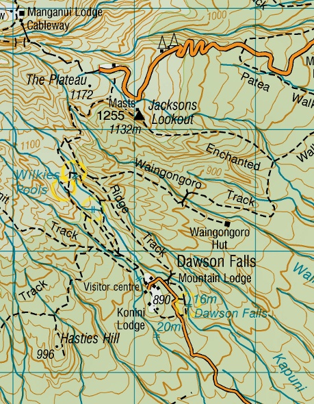
Dawson Falls
Mt Taranaki is a graceful conical 8000-foot volcano on the far west of North Island. It seems to have just one well-known waterfall, Dawson Falls (though the map shows a gaggle of others that I haven't managed to visit yet). The track from the road (inevitably, downhill!) gives a close view of the falls, it needs a 28mm lens and standing as far back as the track will allow (which is not far) to get the whole falls in shot.I'd say it would look better with more water in the left-hand falls than this. Or even, possibly, with none. (April 2007).
54 feet (16m) high, according to A Guide to NZ Waterfalls - and the LINZ map agrees.
And this is strange. All the water is now in the left-hand fall. I thought (from memory) that something looked not quite right. However, the very gloomy day and the pouring rain (you can see it!) are my excuse for the poor exposure and for not investigating the stream above the fall. (April 2011).

Instead, I walked up the track to Wilkies Pools on the Kapuni Stream (the same stream Dawson Falls are on). Googling since suggests there are further pools up beyond here.
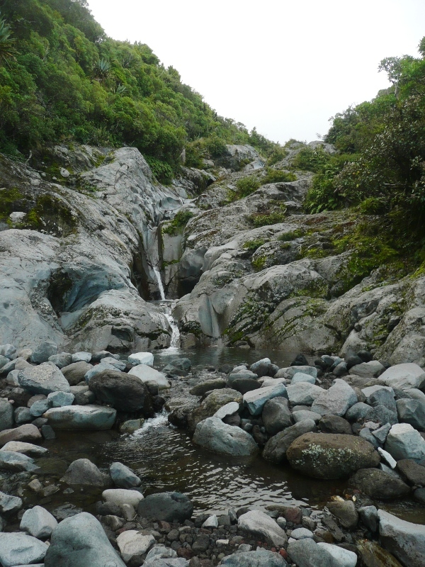
Wilkies Pools, and this fall, probably look more impressive after some rain.