McLaren Falls
On the eastern foothills of the Kaimai Ranges, just off the main Hamilton-Tauranga road, is McLaren Falls Park, surrounding the ex-waterfall that gives its name. I say 'ex' since it ceased to flow in 1925, when the water was stolen for a power station built beside the falls. Later the water was diverted through a canal to Ruahihi power station two miles downstream. However, in 1975, the Kaimai Canoe Club obtained a legal requirement that, on 26 days a year, water would be released down the rapids below the falls for canoeing purposes. Initially this was released through the old power station below the falls, but since this was closed down in 1989 the water has been released through the dam spillway upstream and over the falls. Huge kudos to the canoe club. Now, if I can just track down the list of dates...
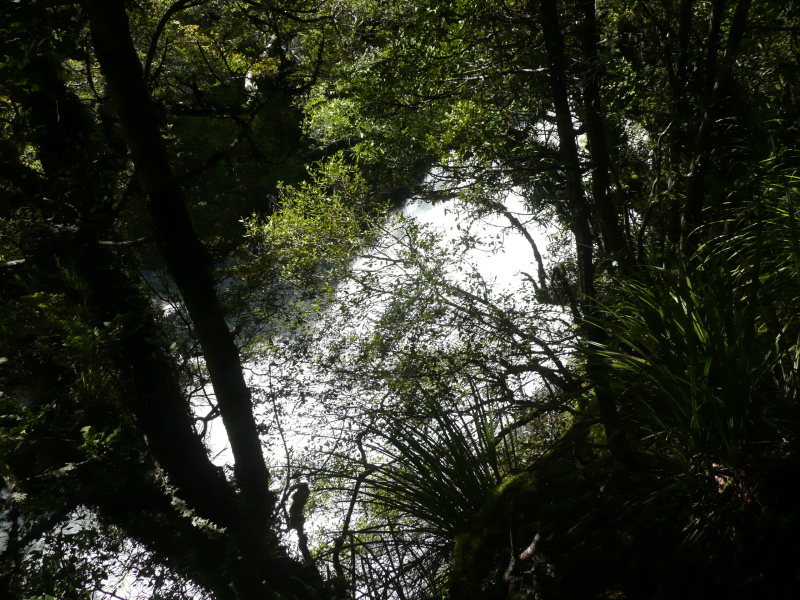
Beyond the falls, a narrow road winds through the extensive park alongside the lake. After half a mile a parking area with a 'Waterfall' sign gives access to a foot track alongside a small stream through the bush. The track runs up one side of the stream for a few hundred yards to the fall, and back down the other side. The fall itself is small but nicely shaped.
Beyond this the road meanders and branches in a confusing fashion, I eventually ignored a large 'No Exit' sign painted on one road and found the way out to McLaren Falls Road.

Omanawa Falls
A few miles to the south-east is Omanawa Falls, another waterfall that has suffered the depredations of hydro power. In a truly spectacular setting, the fall is most striking when flowing full (as Googling shows). However, in 1915 a power station was built in the gorge, lasting until 1998. Unfortunately, from the scenic point of view, in 2007 a 'hydro electricity enthusiast' leased the power station and resumed operations.The track down from the road suddenly arrives at the edge of the gorge and leads into a gallery high up along the side of the gorge. Far below can be seen the waterfall, in quite spectacular surroundings - the fall emerges from a deep cut in the gorge wall, above a huge cave in the cliff face, and falls into a deep blue plunge pool. The gallery ends at a gate, from which a tunnel descends to the power house. Below, on the edge of the pool, can just be seen a platform and a disturbance in the water that suggests most of the flow is entering there.
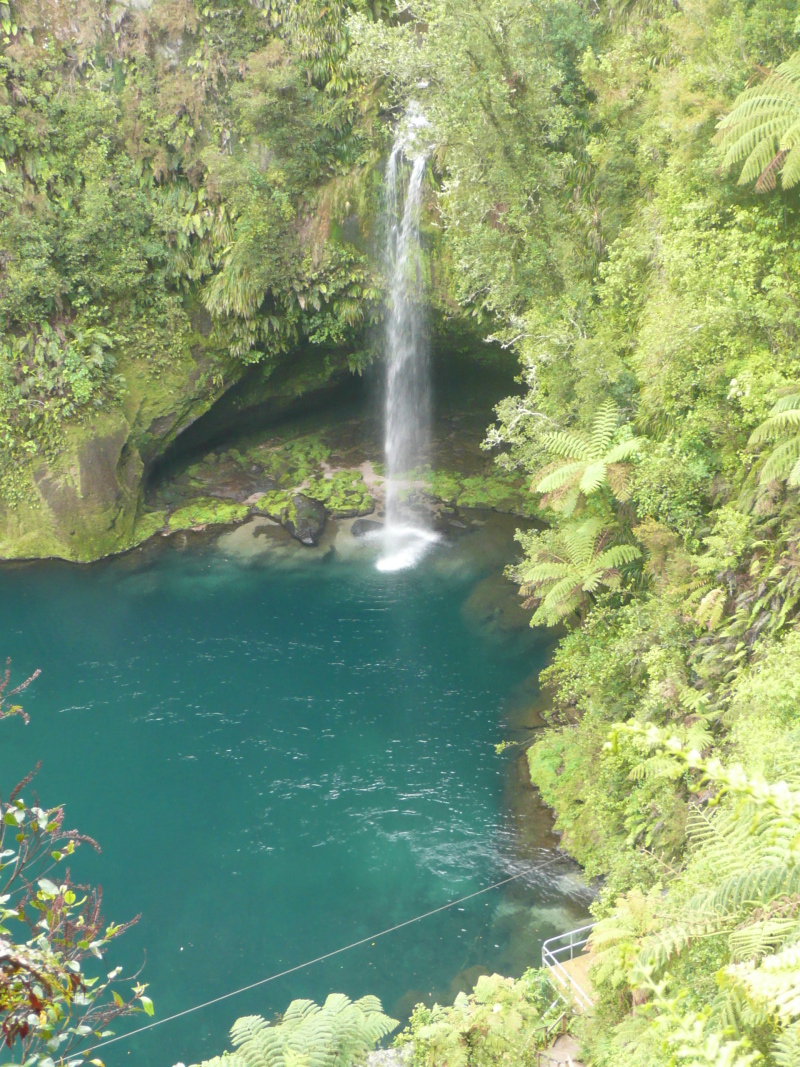
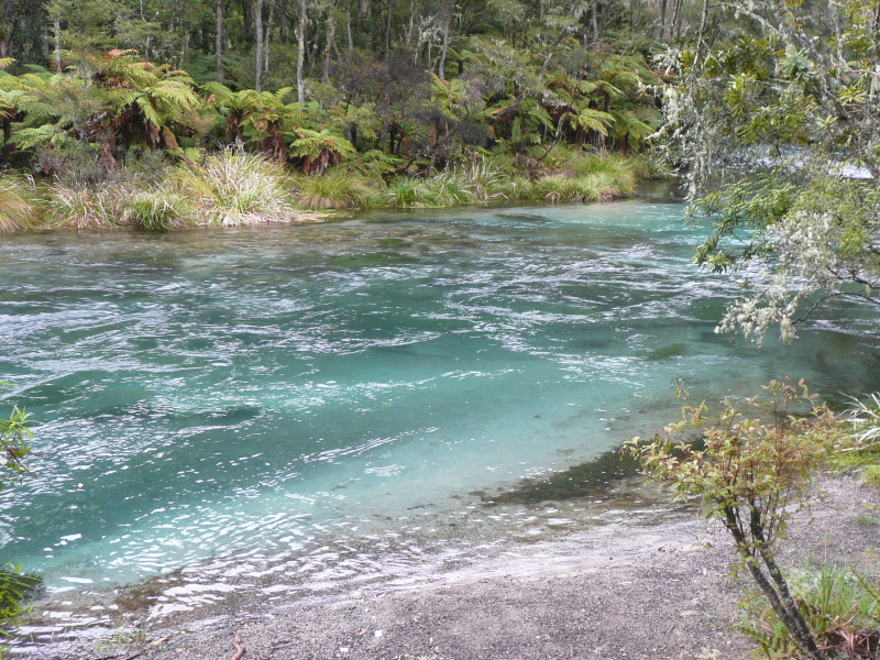
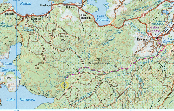
Tarawera Falls
Tarawera Forest access permits are currently (2018) available from the Information Centre, open 9am - 8pm in winter, 'extended hours' in summer, cost $5 - see here , or $6 online here. Forest gates are open from 7-30 till 7-30 (January 2018).
It was a beautiful and most impressive sight.
[1] Height quoted in Wikipedia
[2] Height from 1:50000 map BE38
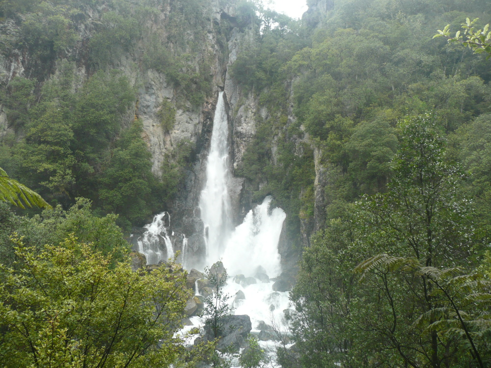
And this is the high fall - an impressive fall by itself

Waikaremoana
Beyond Kawerau lie the Urewera Ranges, bush-covered, green and rainy. The road from Kawerau to Murapara lies through flattish pine forests. (Last petrol at Murupara). Beyond Murupara, the hills start like a ruled line drawn on the map, and the road starts winding. A few miles later you reach the gravel; 65 of the ??? miles between Murupara and Wairoa are gravel.
Totarapapa Falls
A few miles before the small town of Ruatahuna, the map shows a 40m fall on a small stream on the south side of the road. In fact this fall is signposted, it's within a few yards of the road, unfortunately only the lower 10m tier is visible in a deep narrow crack in the hillside, so it isn't very impressive.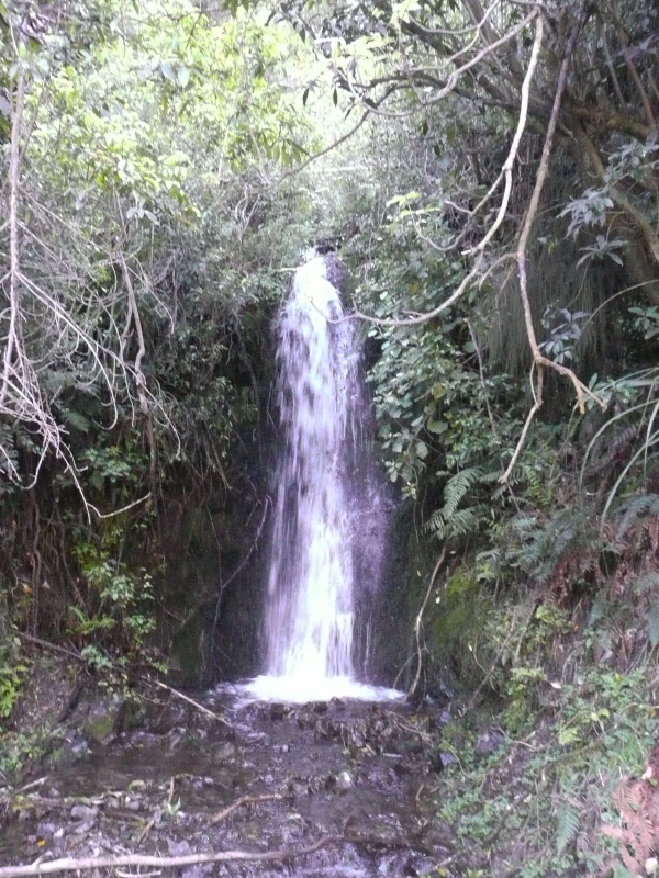

Takapou o Hinewai Cascade
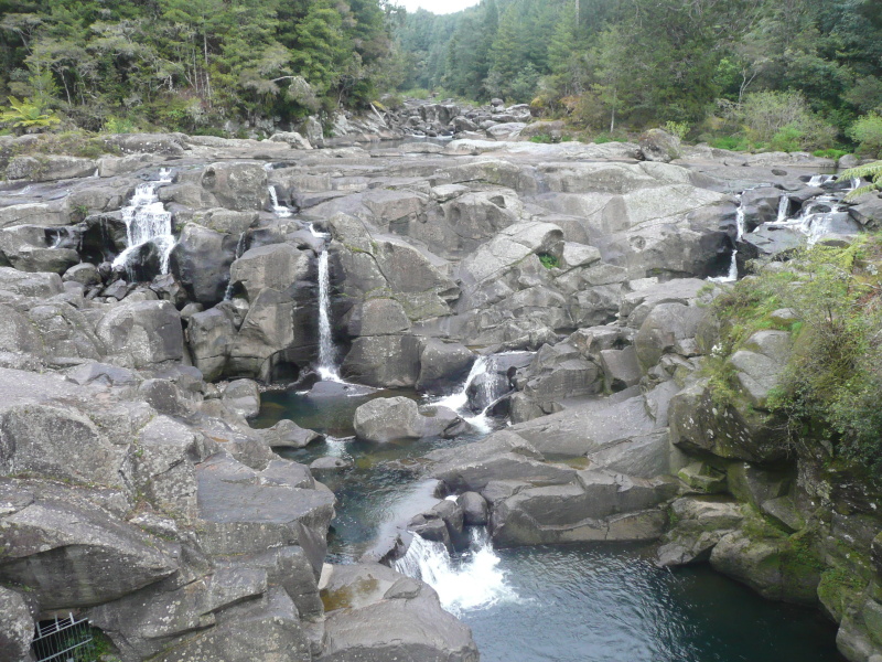
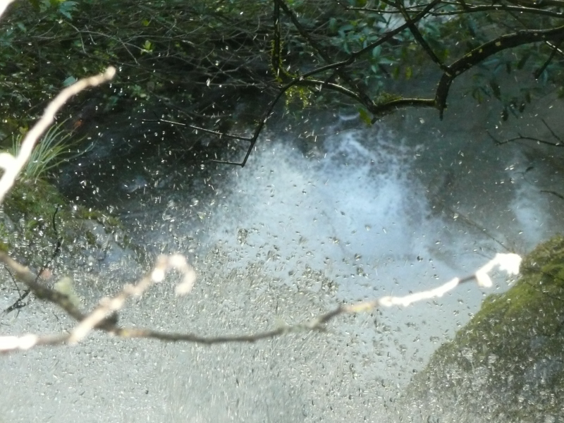
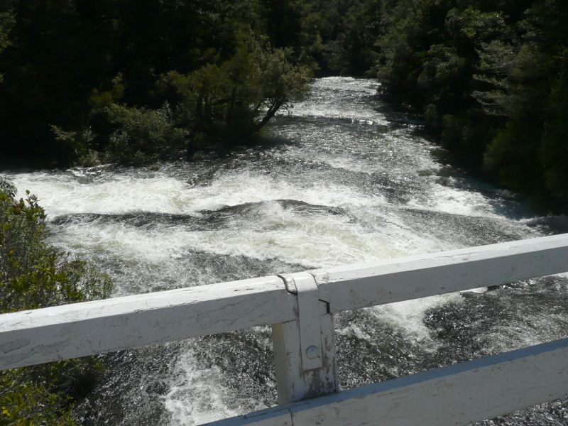
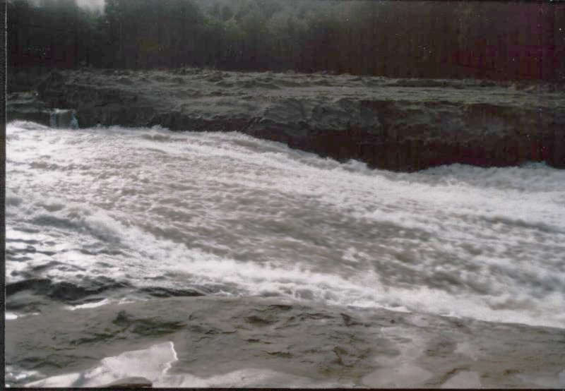
After many more miles of gravel road, the road descends down to Lake Waikaremoana, alongside the Hopuruahine Stream which forms a sizeable rapids at this point. Unfortunately the edge of the road is overgrown with bushes which obstruct any overall viewpoint for the camera.Looking down the rapids

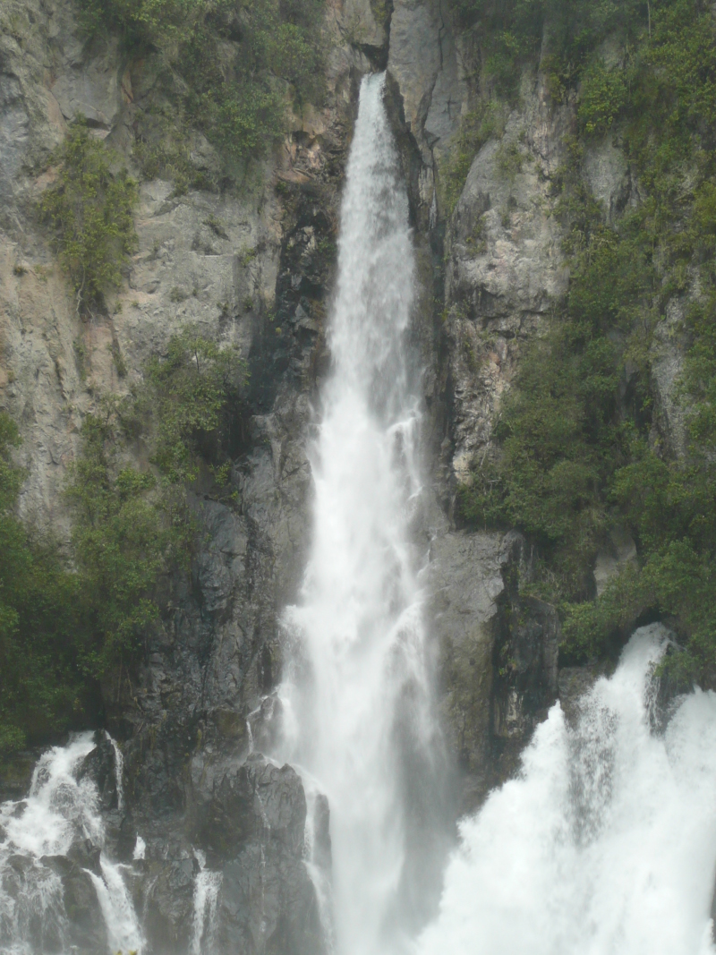
Mokau and Tauwhare Falls
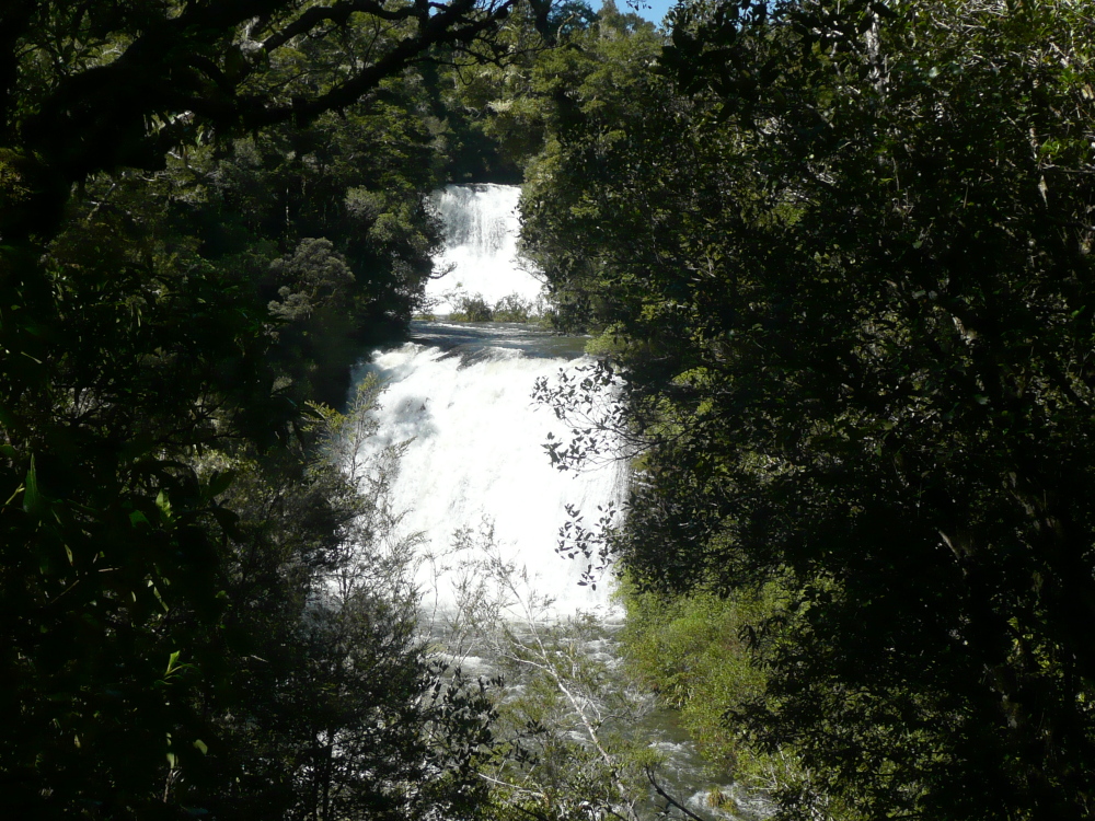
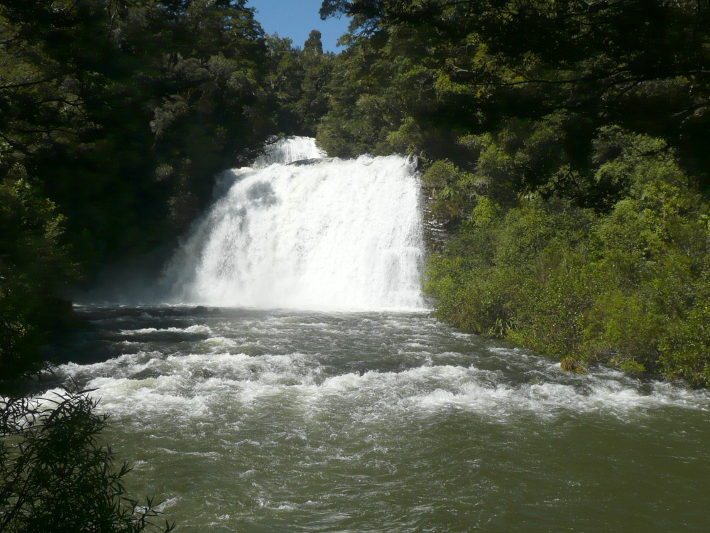
A few miles along the northern edge of the lake, the road loops into the narrow valley of the Mokau Stream. Two waterfalls face each other across the head of the valley. The first one seen is Mokau Falls, 37m. Seen across the valley, the river flows under the road bridge (timber, one-lane) and cascades down a steep rock face. This falls needs a lot of water to adequately cover the full width of the face, as on this fortunate occasion.
Mokau Falls
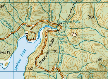
However, the best place to see this waterfall is, by a satisfying symmetry, right above the crest of Mokau Falls.
Looking vertically down Tauwhare Falls
Overlooking the crest of Mokau Falls from the bridge
A closer view of Tauwhare Falls

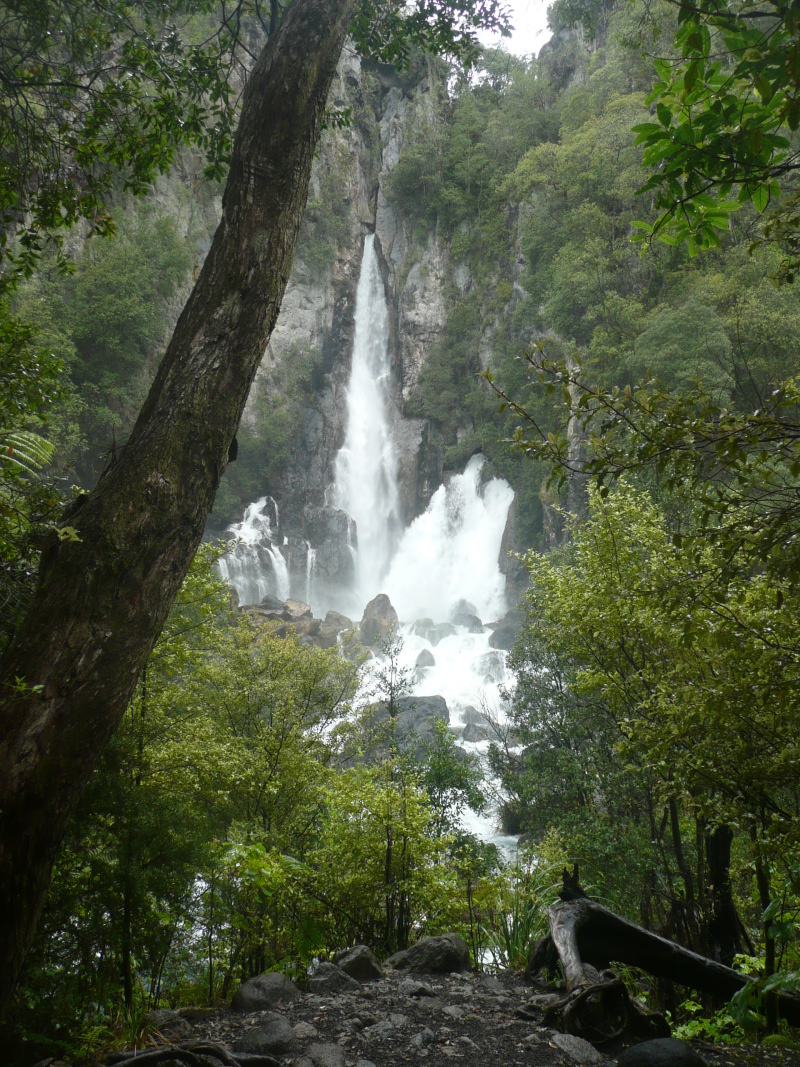
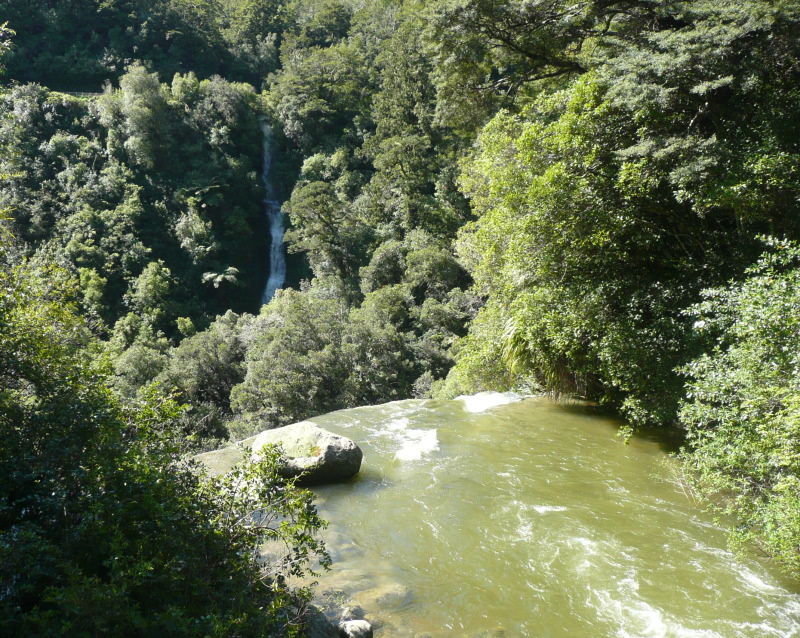
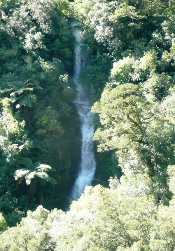
Papakorito Falls
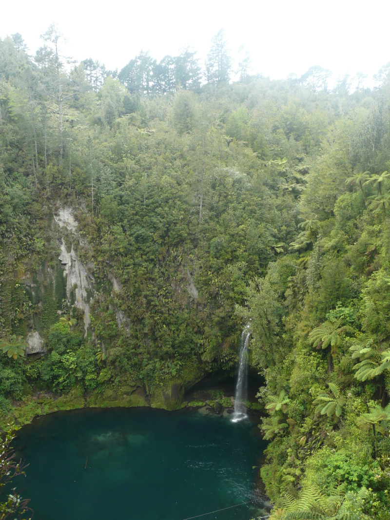
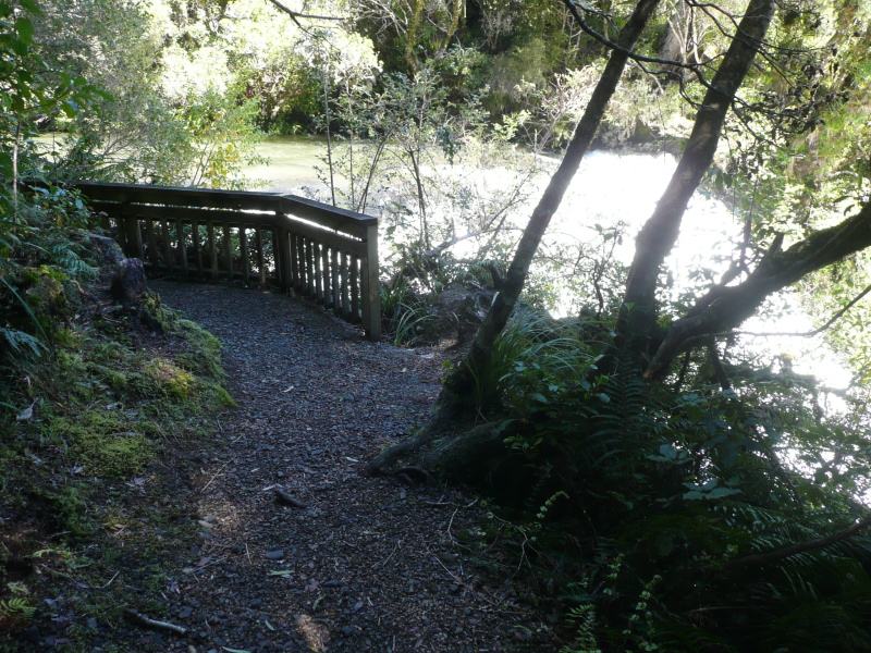
There's a cluster of waterfalls on the Aniwaniwa Stream (hey! some of these streams are full-grown rivers, I think) which flows into the lake by the Waikaremoana visitor centre. Curiously enough, in this region, the valley of the Aniwaniwa Stream is broad and flat. A mile upstream from the main road bridge is Papakorito Falls. You can see it from the car park at the end of Aniwaniwa Road. A wide well-proportioned fall, 20m high, with a sloping base that makes the water fan out at the bottom (the Aniwaniwa falls downstream have this trick, too).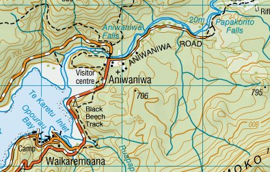
Aniwaniwa Falls
How to lose a waterfall
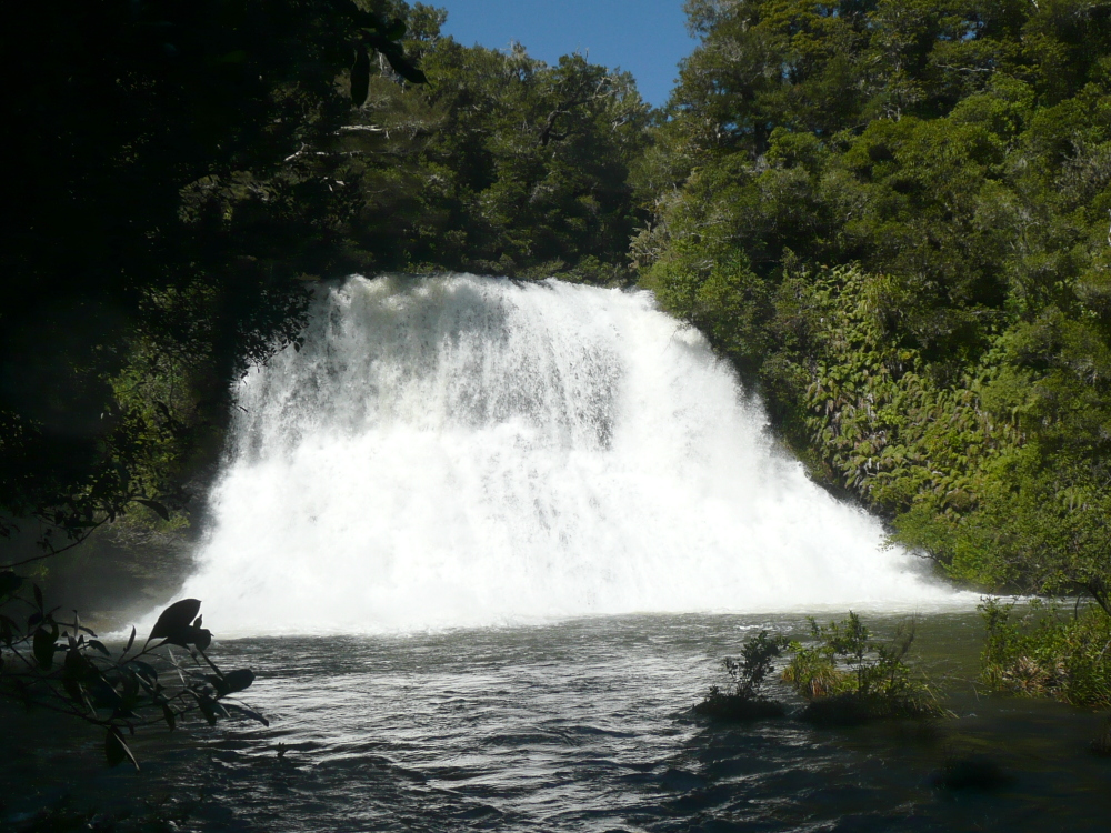
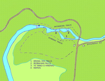
Below the road, on the same river are three good-sized falls, Bridal Veil falls, Momahaki Falls and Te Tangi o Hinerau Falls - collectively, Aniwaniwa Falls. And they caused me (and probably many others) very considerable confusion. The saga commences...(The photo captions were of course all added later, when I'd worked out which fall was which).
If you can't stand the suspense, scroll to the bottom of this section where the map explains all. "The answer, when found, will be obvious" - but it certainly wasn't obvious to me at the time.


Bridal Veil Fall 15m (50 feet)

Momahaki Falls 15m (50 feet)
Te Tangi o Hinerau Falls 11m (36 feet)
Four-foot fall in foreground, upper fall in right distance,
??Bridal Veil stream channel on left?

Momahaki Falls
Right.
That's two falls.
Two falls?
I walked up and down the track twice, carefully counting waterfalls to make sure I hadn't missed any. I concluded the author of the Guide must have mistaken Bridal Veil Falls, when seen in the distance from below Aniwaniwa Fall, for a third waterfall.
Te Tangi o Hinerau Falls
(None of the falls show up well on the photo as it was taken in the morning with the sun in the east.)
(And I've just found DOC's Lake Waikaremoana site which says "The first fall is the 15 m Bridal Veil fall. The Momahaki Fall is on the other side of an island in the middle of the river. This fall, together with the 11 metre lower fall form a spectacular sight from the next viewpoint down." So that confirms it.)
The river tears across a sloping rock shelf...
...and over into the chasm.
A small stream takes the 'long way round' and
cascades down the end of the gorge (top of picture).
Te Reinga Falls
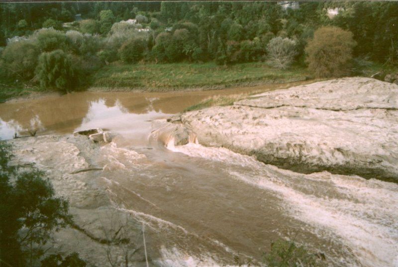
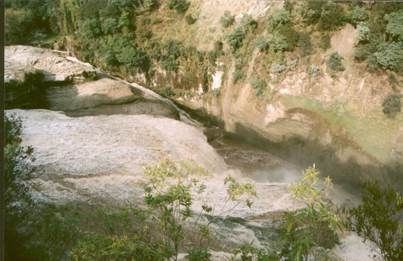
15 miles northeast of Wairoa and just beside the secondary 'inland' road to Gisborne, lie the Te Reinga Falls. These falls are not elegant or graceful. They look dangerous, violent and rough at any state of flow. The water flows smoothly through the remains of a large concrete V-notch measuring weir then races across a broad sloping shelf of water-worn bare rock riverbed before plunging 35m (115') into a deep narrow chasm. You can approach the side of the torrent but everything about it says "This river means business - don't fall in".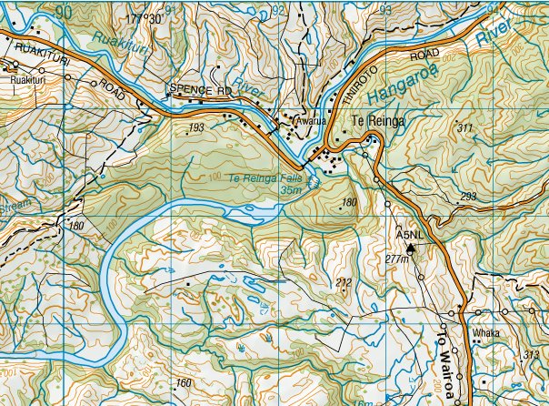
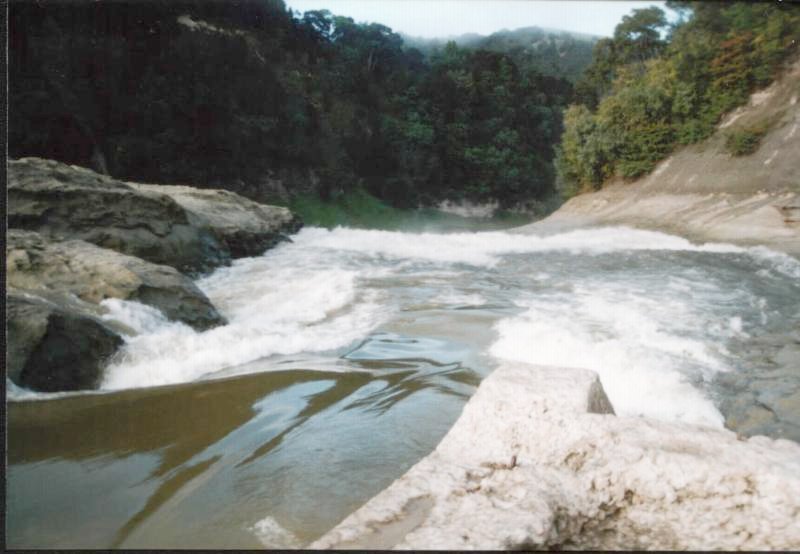
Seen from the top end by the V-notch weir
This is as close as I'd ever want to get. That water's
moving like an express train
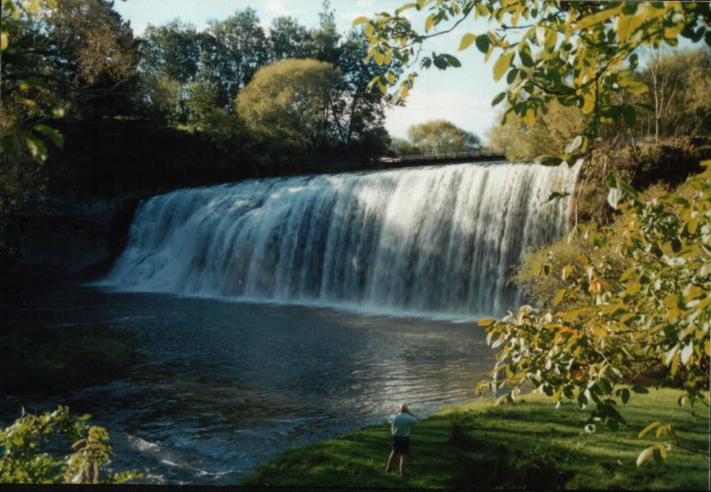
Rere Falls
20 miles west-north-west of Gisborne by remote (but tarsealed) country road, lies Rere Falls, a very graceful broad waterfall and quite surprisingly 'tame' in this rather wild countryside. The road crosses the stream in a bridge just above the falls (just visible in the photo).